Fitxategi:BahamasOMC.png
Aurreikuspen honen neurria: 597 × 600 pixel. Bestelako bereizmenak: 239 × 240 pixel | 478 × 480 pixel | 927 × 931 pixel.
Bereizmen handikoa ((927 × 931 pixel, fitxategiaren tamaina: 61 KB, MIME mota: image/png))
Fitxategi hau Wikimedia Commonsekoa da. Hango deskribapen orriko informazioa behean duzu. |
Laburpena
| Deskribapena |
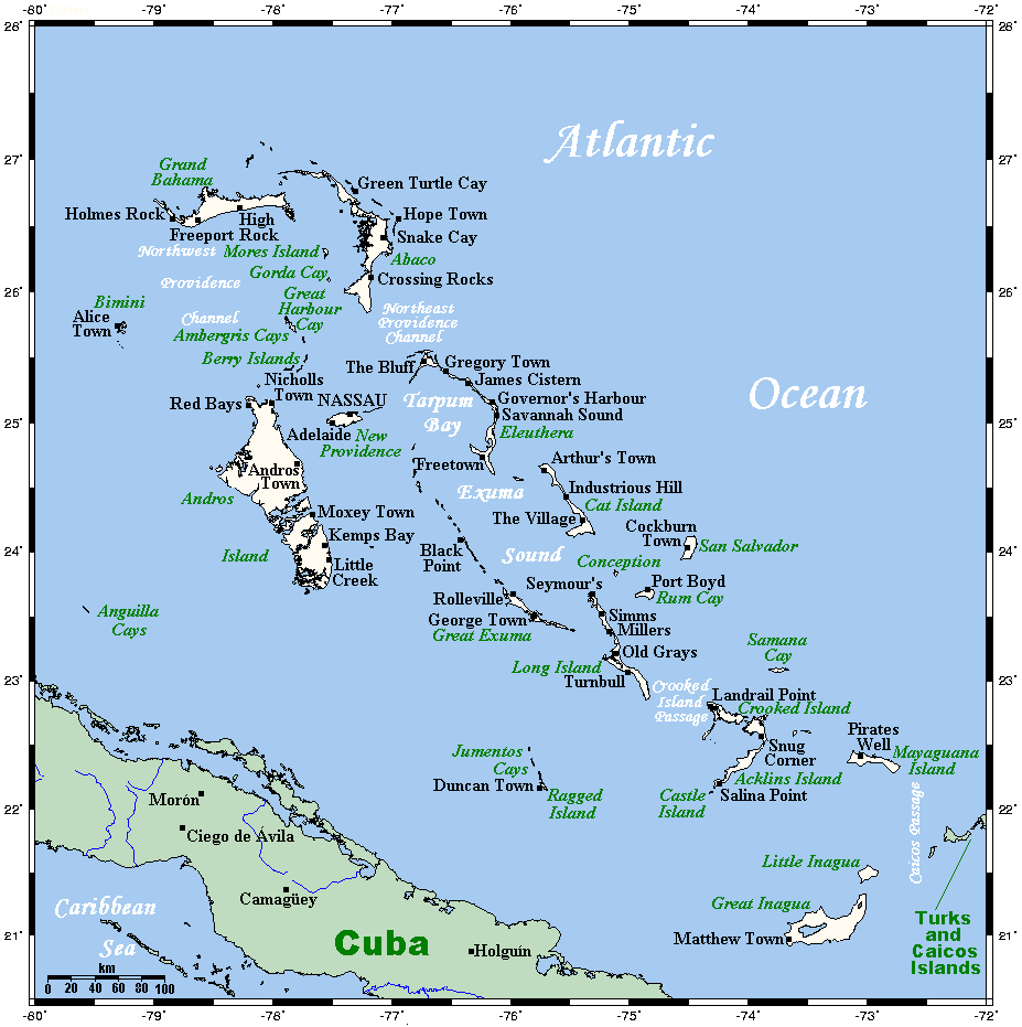
English: A map showing the Bahamas' cities and main towns. This map's source is here, with the uploader's modifications, and the GMT homepage says that the tools are released under the GNU General Public License. |
| Data | 2007ko uztailaren 29a (Jatorrizko igoera-data) |
| Jatorria | Transferred from en.wikipedia |
| Egilea | Original uploader was Kelisi at en.wikipedia |
| Lizentzia (Fitxategi hau berrerabiltzen) |
CC-BY-SA-3.0-MIGRATED; Released under the GNU Free Documentation License. |
Lizentzia
| Fitxategi hau Creative Commons Attribution-Share Alike 3.0 Unported lizentziapean dago. | ||
| ||
| This licensing tag was added to this file as part of the GFDL licensing update. |
Kelisi from en.wikipedia.org, lan honen egileak, argitaratu du edo argitaratzen du ondorengo lizentzia pean:
| Fitxategi hau Creative Commons Attribution-Share Alike 3.0 Unported lizentziapean dago. Subject to disclaimers. | ||
| Aitortu: Kelisi from en.wikipedia.org | ||
| ||
| This licensing tag was added to this file as part of the GFDL licensing update. |

|
Baimena duzu dokumentu hau kopiatu, banatu edo/eta aldatzeko GNU Free Documentation License baldintzapean, Free Software Foundationek argitaratutako 1.2 edo ondorengo bertsioan; sekzio aldaezinik gabe, azaleko testurik gabe, eta atzeko azaleko testurik gabe. Lizentziaren kopia dago GNU Free Documentation License izenburudun atalean. Subject to disclaimers. |
Jatorrizko igoera erregistroa
The original description page was here. All following user names refer to en.wikipedia.
- 2009-11-03 04:19 Kelisi 927×931× (62625 bytes) Same author, same licence, a couple of modifications (Andros Town is bigger than Hard Bargain, and the Anguilla Cays deserve a mention).
- 2007-07-29 03:41 Kelisi 928×931× (43996 bytes) == Summary == A map showing the Bahamas' cities and main towns. This map's source is [http://www.aquarius.ifm-geomar.de/ here], with the uploader's modifications, and the [http://gmt.soest.hawaii.edu/ GMT homepage] says that the tools are released under t
Fitxategiaren historia
Data/orduan klik egin fitxategiak orduan zuen itxura ikusteko.
| Data/Ordua | Iruditxoa | Neurriak | Erabiltzailea | Iruzkina | |
|---|---|---|---|---|---|
| oraingoa | 19:23, 12 abendua 2010 | | 927 × 931 (61 KB) | Urdangaray | {{Information |Description={{en|<nowiki><math>Insert non-formatted text here</math>en:Media:Example.ogg</nowiki>== Summary == A map showing the Bahamas' cities and main towns. This map's source is [http://www.aquarius.ifm-geomar.de/ here], with the |
Irudira dakarten loturak
Hurrengo orrialdeek dute fitxategi honetarako lotura:
Fitxategiaren erabilera orokorra
Hurrengo beste wikiek fitxategi hau darabilte:
- af.wikipedia.org proiektuan duen erabilera
- az.wiktionary.org proiektuan duen erabilera
- en.wikipedia.org proiektuan duen erabilera
- eo.wikipedia.org proiektuan duen erabilera
- es.wikipedia.org proiektuan duen erabilera
- ka.wikipedia.org proiektuan duen erabilera
- mad.wikipedia.org proiektuan duen erabilera
- mk.wikipedia.org proiektuan duen erabilera
- zh.wikipedia.org proiektuan duen erabilera