Fitxategi:Zoarville Bridge.jpg
Aurreikuspen honen neurria: 439 × 600 pixel. Bestelako bereizmenak: 176 × 240 pixel | 351 × 480 pixel | 562 × 768 pixel | 750 × 1.024 pixel | 1.499 × 2.048 pixel | 3.154 × 4.308 pixel.
Bereizmen handikoa ((3.154 × 4.308 pixel, fitxategiaren tamaina: 1,65 MB, MIME mota: image/jpeg))
Fitxategi hau Wikimedia Commonsekoa da. Hango deskribapen orriko informazioa behean duzu. |
| Kameraren kokapena | | Irudi hau eta gehiago beraien kokapenekin hurrengo lekuetan: OpenStreetMap |
|---|
|
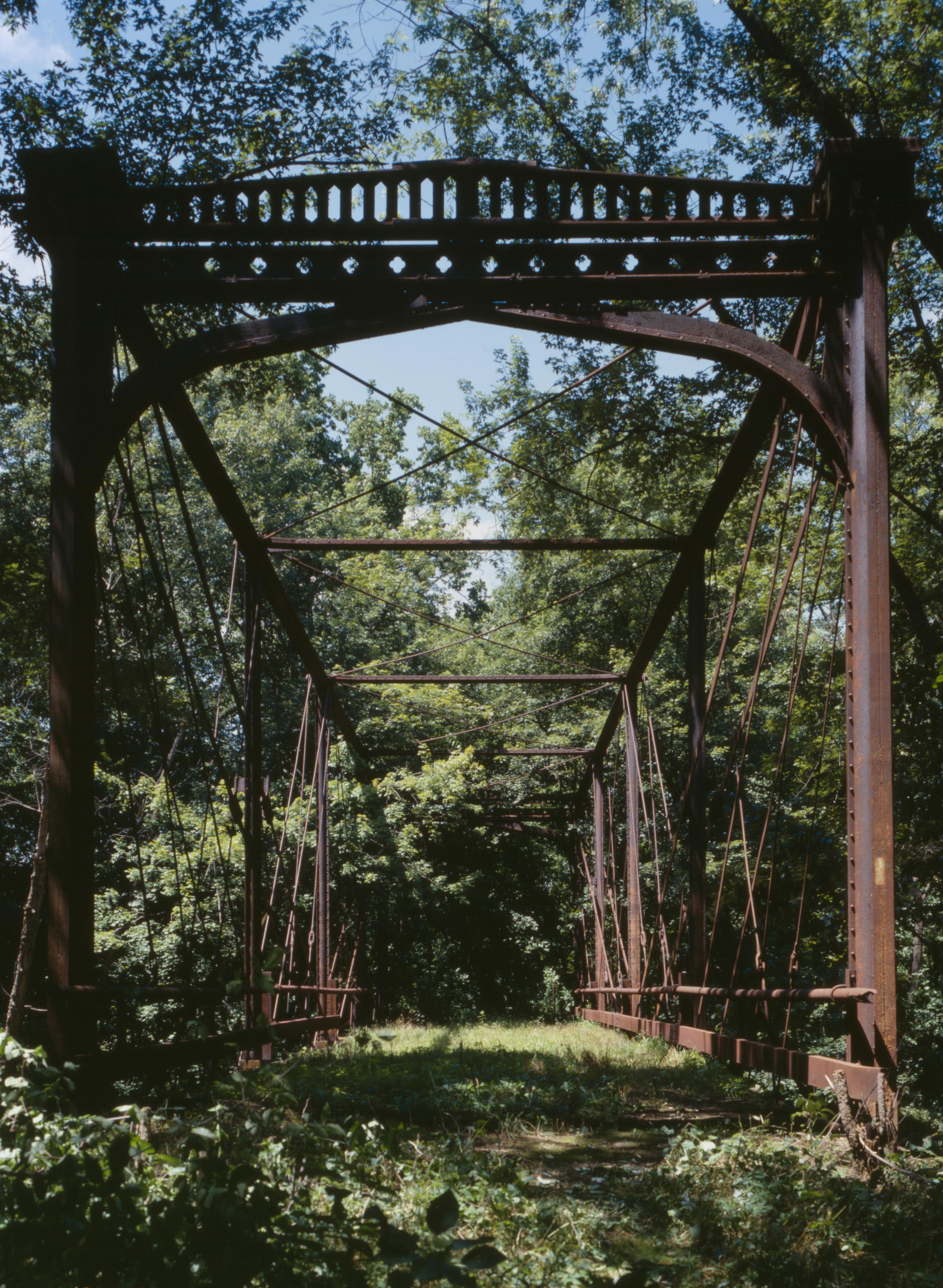
This is an image of a place or building that is listed on the National Register of Historic Places in the United States of America. Its reference number is 97000199. |
| Deskribapena |
English: Southern end of the Zoarville Bridge, which spans Conotton Creek southeast of Zoarville in Fairfield Township, Tuscarawas County, Ohio, United States. Built in 1868 and listed on the National Register of Historic Places, it is the only Fink through truss bridge in the United States. |
||||
| Data | |||||
| Jatorria |
Library of Congress, Prints and Photograph Division HAER: OHIO,79-ZOARV.V,1-18
|
||||
| Egilea | Joseph Elliott | ||||
| Lizentzia (Fitxategi hau berrerabiltzen) |
|

Fitxategiaren historia
Data/orduan klik egin fitxategiak orduan zuen itxura ikusteko.
| Data/Ordua | Iruditxoa | Neurriak | Erabiltzailea | Iruzkina | |
|---|---|---|---|---|---|
| oraingoa | 18:46, 27 apirila 2009 | | 3.154 × 4.308 (1,65 MB) | Martin H. | high res; cropped |
| 04:56, 26 apirila 2009 |  | 817 × 1.024 (329 KB) | Nyttend | {{Location|40|34|38|N|81|23|30|W}} {{Information |Description={{en|Southern end of the {{w|Zoarville Bridge}}, which spans Conotton Creek southeast of Zoarville in {{w|Fairfield Township, Tuscarawas County, Ohio|Fairfield Township}}, {{w|Tuscarawas County |
Irudira dakarten loturak
Hurrengo orrialdeek dute fitxategi honetarako lotura:
Fitxategiaren erabilera orokorra
Hurrengo beste wikiek fitxategi hau darabilte:
- en.wikipedia.org proiektuan duen erabilera
- es.wikipedia.org proiektuan duen erabilera
- fa.wikipedia.org proiektuan duen erabilera
- pt.wikipedia.org proiektuan duen erabilera
- ur.wikipedia.org proiektuan duen erabilera
- vi.wikipedia.org proiektuan duen erabilera
- www.wikidata.org proiektuan duen erabilera
- zh.wikipedia.org proiektuan duen erabilera