Fitxategi:Uniopolis Town Hall, eastern side.jpg
Aurreikuspen honen neurria: 800 × 450 pixel. Bestelako bereizmenak: 320 × 180 pixel | 640 × 360 pixel | 1.024 × 576 pixel | 1.280 × 720 pixel | 2.816 × 1.584 pixel.
Bereizmen handikoa ((2.816 × 1.584 pixel, fitxategiaren tamaina: 1,93 MB, MIME mota: image/jpeg))
Fitxategi hau Wikimedia Commonsekoa da. Hango deskribapen orriko informazioa behean duzu. |
|
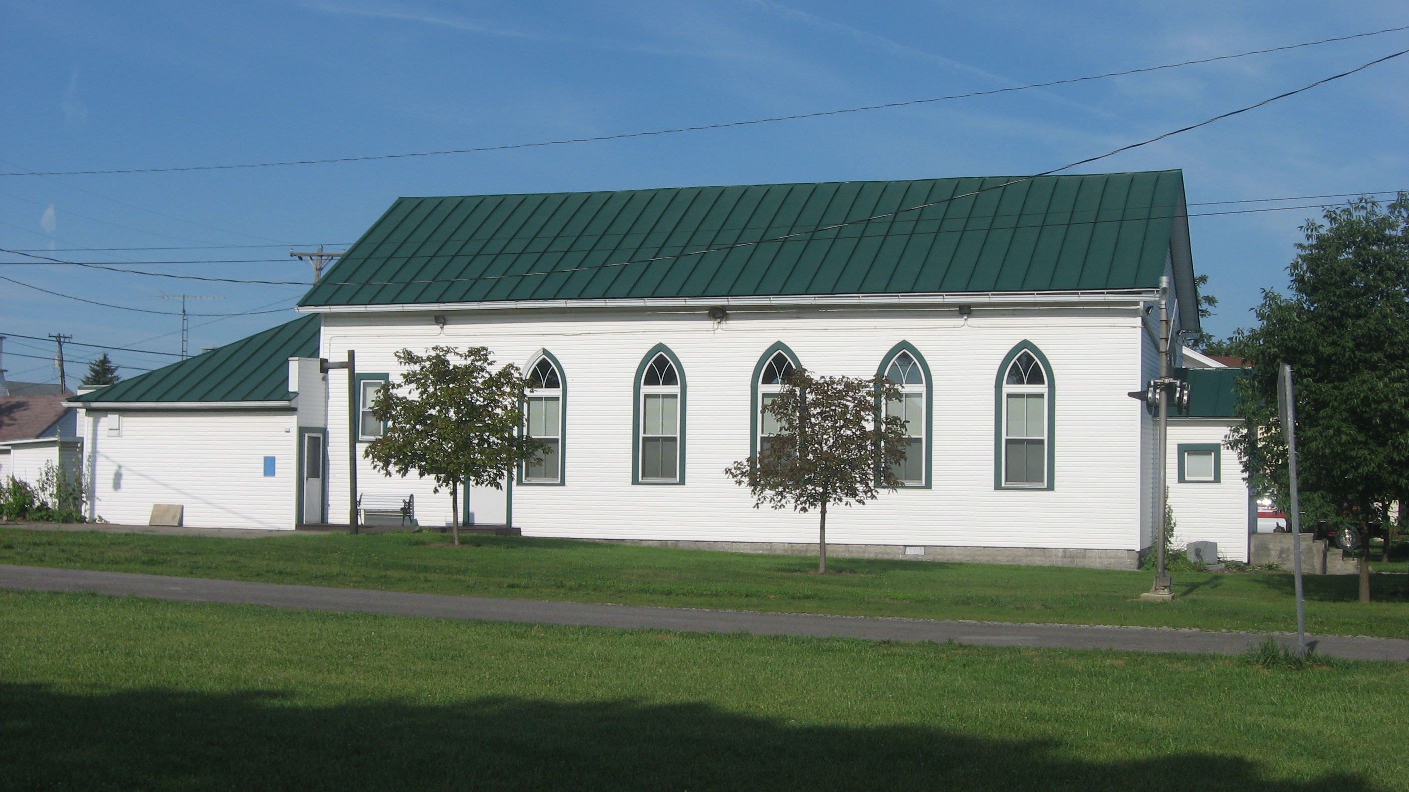
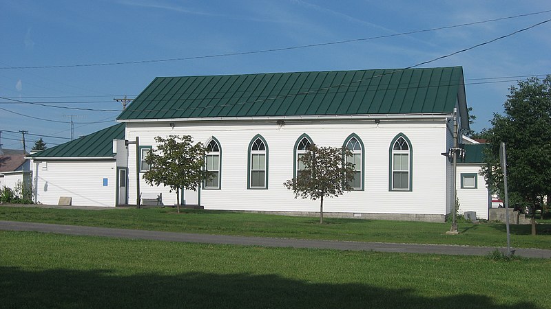
This is an image of a place or building that is listed on the National Register of Historic Places in the United States of America. Its reference number is 94000773. |
| Kameraren kokapena | | Irudi hau eta gehiago beraien kokapenekin hurrengo lekuetan: OpenStreetMap |
|---|
| Deskribapena |
English: Eastern side of the Uniopolis Town Hall, located along Ohio Street (State Route 67) at its intersection with Mill Street in Uniopolis, Ohio, United States. Once a congregation of the Church of the United Brethren in Christ, it now serves as the location of the municipal offices and of the Uniopolis Historical Society Museum, and is listed on the National Register of Historic Places. |
||
| Data | Taken on 2010ko uztailaren 26a | ||
| Jatorria | Norberak egina | ||
| Egilea | Nyttend | ||
| Lizentzia (Fitxategi hau berrerabiltzen) |
|
Fitxategiaren historia
Data/orduan klik egin fitxategiak orduan zuen itxura ikusteko.
| Data/Ordua | Iruditxoa | Neurriak | Erabiltzailea | Iruzkina | |
|---|---|---|---|---|---|
| oraingoa | 04:28, 27 uztaila 2010 | | 2.816 × 1.584 (1,93 MB) | Nyttend | {{Location|40|36|8|N|84|5|15|W}} {{Information |Description={{en|Eastern side of the {{w|Uniopolis Town Hall}}, located along Ohio Street ({{w|Ohio State Route 67|State Route 67}}) at its intersection with Mill Street in {{w|Uniopolis, Ohio|Uniopolis}}, { |
Irudira dakarten loturak
Hurrengo orrialdeek dute fitxategi honetarako lotura:
Fitxategiaren erabilera orokorra
Hurrengo beste wikiek fitxategi hau darabilte:
- ar.wikipedia.org proiektuan duen erabilera
- arz.wikipedia.org proiektuan duen erabilera
- azb.wikipedia.org proiektuan duen erabilera
- ca.wikipedia.org proiektuan duen erabilera
- ceb.wikipedia.org proiektuan duen erabilera
- en.wikipedia.org proiektuan duen erabilera
- es.wikipedia.org proiektuan duen erabilera
- ht.wikipedia.org proiektuan duen erabilera
- it.wikipedia.org proiektuan duen erabilera
- lld.wikipedia.org proiektuan duen erabilera
- pt.wikipedia.org proiektuan duen erabilera
- sh.wikipedia.org proiektuan duen erabilera
- sr.wikipedia.org proiektuan duen erabilera
- vi.wikipedia.org proiektuan duen erabilera
- www.wikidata.org proiektuan duen erabilera
- zh-min-nan.wikipedia.org proiektuan duen erabilera