Fitxategi:Trinity Church of Scotland Inverness Scotland (15074761531).jpg
Bereizmen handikoa ((2.956 × 2.800 pixel, fitxategiaren tamaina: 416 KB, MIME mota: image/jpeg))
Fitxategi hau Wikimedia Commonsekoa da. Hango deskribapen orriko informazioa behean duzu. |
.jpg)
Laburpena
| Deskribapena |
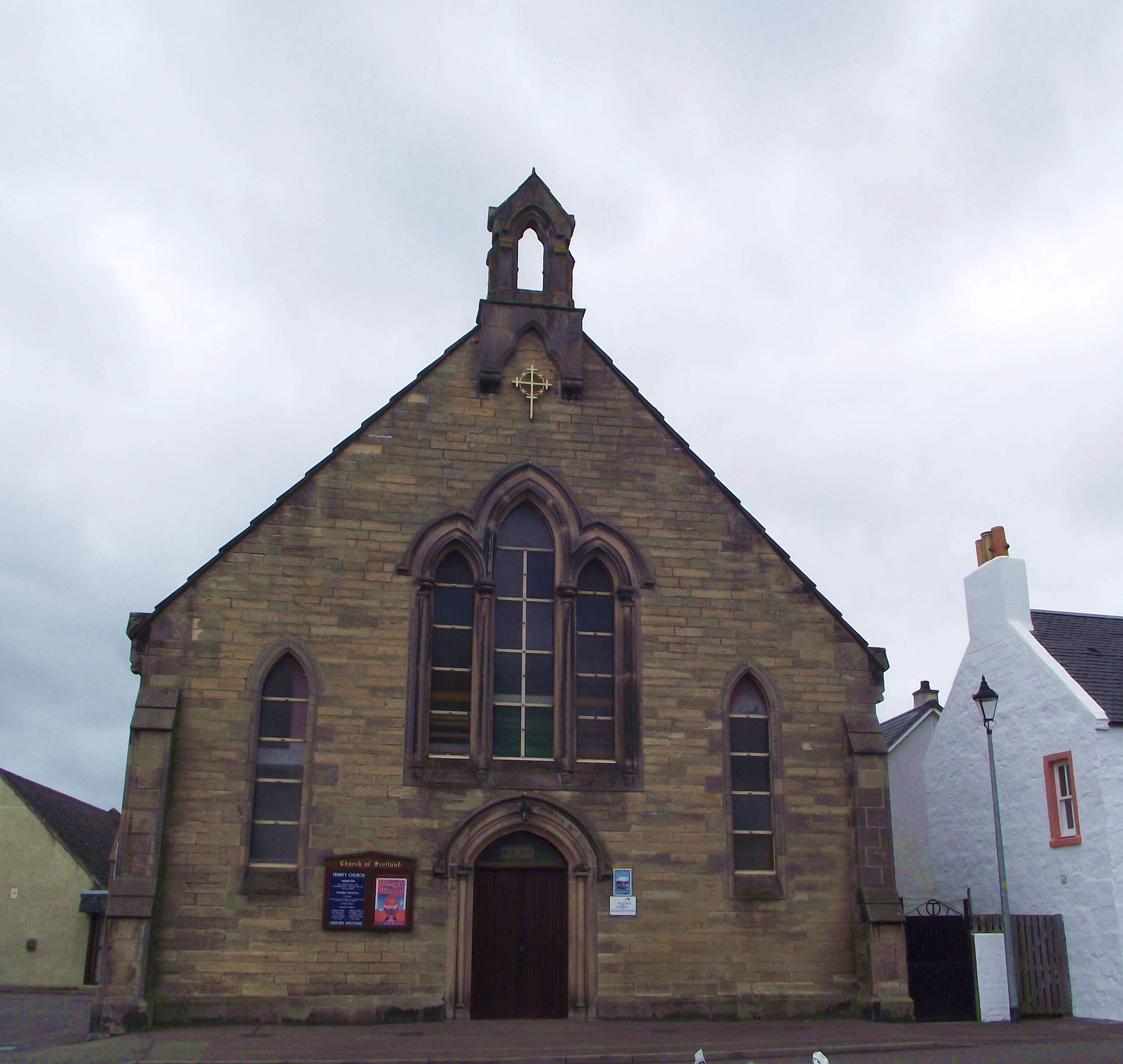
St Marks Church a.k.a Trinity Church a.k.a West Free Church (Huntly Place) The furthest down stream of the many Ness-side Churches, it is one of few to have no spire (and no bell either nowadays!). Built to a more austere, but no less aesthetic, style than most of the churches along the river, it was always a busy place. Built in 1863, the building appears on the 1867 OS map as "West Free Church", and it was then OUTSIDE the Burgh of inverness. The Municipal boundary was the centre of Upper Kessock Street, and the Church was actually then designated on U/K Street, with Huntly Place not starting till the row of houses beyond the (now gone) cottage attached to the Church. In 1867 it was shown as able to seat 475, and the hall on the back did not come until later. The building later became the Parish Church for Merkinch, before merging with Queen Street Church in 1971. Although it was thought by many that St Marks might close in favour of the larger Queen Street Church, it was decided to dispose of Queen Street and centre the congregation on St Marks, renaming the building Trinity Church (much easier to say, and remember, than "St Marks, Quuen Street and Merkinch"). The third part of the "Trinity" was the famous and well-loved "Hall Church" in Thornbush Road, built in 1939, latterly part of St Marks' Parish (with the resulting title of Merkinch St Marks) - which could be converted from a religious service venue to a Youth Fellowship Disco or a theatre or lecture room or Burns Supper Dining Room or Games Hall in a matter of an hour - and then back again as quickly (allowing for sufficient helping hands)! As part of the work undertaken to moderise and extend "St Marks" post-merger, the hall to the rear was enlarged and extended, and the adjacent house removed to form a car park, and the Hall Church was also sold off for business use. The inspirational minister (first of Merkich St Marks, and from 1971 of the join congregation) for more than 37 years was Rev. Norman I. MacRae (who retired in 2003) The writer for one "found" St Marks as a teenager - initally the Boys Brigade 6th Company ("the Super Sixth") - while living nearby in mid-late 1960s, and a house-move soon after to New Hilton did not deter him, or the other "displaced" Merkinchers/Carsers, from the part-bus/part-walk trek 3 or 4 times a week (BBs on Fridays, Badminton Saturdays, BB Bible Class/Church Sunday morning; Church/Youth Fellowship Sunday evening). Mind you, there were compensations - such as the large choice of venues to purchase chips in newspaper on the way from/to Town Centre bus stop; picking up the Football Times on Saturday evening from shop on Huntly Street to find out all the football results and read the reports of all the Highland League games. (Downside - Sunday evenings had no bus to HIlton though, but thankfully a lift was usually available). Scary to think that was 45 years ago! More information on the history can be obtained from the Church's website:- trinityinverness.org.uk/about/ |
| Data | |
| Jatorria | Trinity Church of Scotland Inverness Scotland |
| Egilea | Dave Conner from Inverness, Scotland |
| Kameraren kokapena | | Irudi hau eta gehiago beraien kokapenekin hurrengo lekuetan: OpenStreetMap |
|---|
.jpg¶ms=057.482220_N_-004.235261_E_globe:Earth_type:camera_source:Flickr_&language=eu)
Lizentzia
- Askea zara:
- partekatzeko – lana kopiatzeko, banatzeko eta bidaltzeko
- birnahasteko – lana moldatzeko
- Ondorengo baldintzen pean:
- eskuduntza – Egiletza behar bezala aitortu behar duzu, lizentzia ikusteko esteka gehitu, eta ea aldaketak egin diren aipatu. Era egokian egin behar duzu hori guztia, baina inola ere ez egileak zure lana edo zure erabilera babesten duela irudikatuz.
| This image was originally posted to Flickr by conner395 at https://www.flickr.com/photos/91779914@N00/15074761531. It was reviewed on 2014ko irailaren 29a by FlickreviewR and was confirmed to be licensed under the terms of the cc-by-2.0. |
Fitxategiaren historia
Data/orduan klik egin fitxategiak orduan zuen itxura ikusteko.
| Data/Ordua | Iruditxoa | Neurriak | Erabiltzailea | Iruzkina | |
|---|---|---|---|---|---|
| oraingoa | 22:03, 29 iraila 2014 | | 2.956 × 2.800 (416 KB) | Vclaw | Transferred from Flickr via Flickr2commons |
Irudira dakarten loturak
Hurrengo orrialdeek dute fitxategi honetarako lotura:
Fitxategiaren erabilera orokorra
Hurrengo beste wikiek fitxategi hau darabilte:
- en.wikipedia.org proiektuan duen erabilera
- ga.wikipedia.org proiektuan duen erabilera
- www.wikidata.org proiektuan duen erabilera
.jpg)