Fitxategi:Tibet provinces.png
Aurreikuspen honen neurria: 800 × 555 pixel. Bestelako bereizmenak: 320 × 222 pixel | 640 × 444 pixel | 1.024 × 711 pixel | 1.421 × 986 pixel.
Bereizmen handikoa ((1.421 × 986 pixel, fitxategiaren tamaina: 871 KB, MIME mota: image/png))
Fitxategi hau Wikimedia Commonsekoa da. Hango deskribapen orriko informazioa behean duzu. |
| Deskribapena |
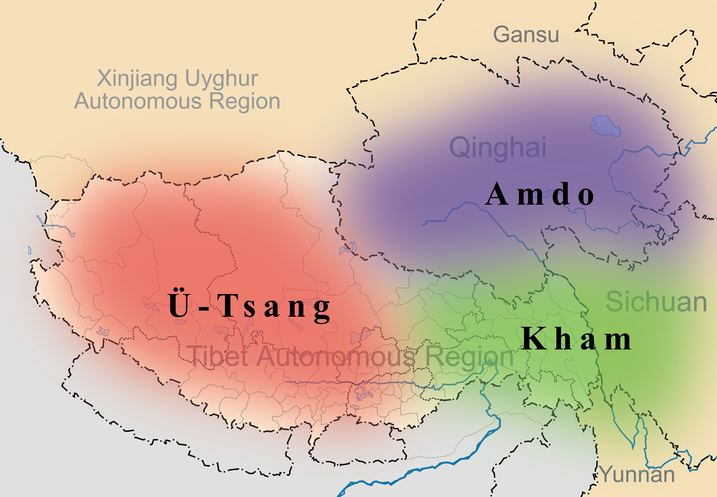
English: A simple map of the three traditional provinces of Tibet overlaid on a map of modern provincial boundaries of the People's Republic of China. |
| Data | (UTC) |
| Jatorria | |
| Egilea |
|
| This is a retouched picture, which means that it has been digitally altered from its original version. Modifications: added traditional provinces overlay. The original can be viewed here: Map of Tibet Ü-Tsang Amdo and Kham.jpg:
|
Fitxategi hau Creative Commons Attribution-Share Alike 3.0 Unported lizentziapean dago.
- Askea zara:
- partekatzeko – lana kopiatzeko, banatzeko eta bidaltzeko
- birnahasteko – lana moldatzeko
- Ondorengo baldintzen pean:
- eskuduntza – Egiletza behar bezala aitortu behar duzu, lizentzia ikusteko esteka gehitu, eta ea aldaketak egin diren aipatu. Era egokian egin behar duzu hori guztia, baina inola ere ez egileak zure lana edo zure erabilera babesten duela irudikatuz.
- berdin partekatu – Lan honetan oinarrituta edo aldatuta berria eraikitzen baduzu, emaitza lana hau bezalako lizentzia batekin argitaratu behar duzu.
Jatorrizko igoera erregistroa
This image is a derivative work of the following images:
- File:Tibet&neighbors_Locator_map.svg licensed with Cc-by-sa-3.0, GFDL
- 2009-10-13T22:22:54Z Keithonearth 1520x1059 (188220 Bytes) {{Information |Description={{en|1=A simple map of the Tibetan Autonomous Region, and surrounding Nations, and States. It was made for [[:en:Template:Location map China Tibet]].}} |Source={{own}} |Author=[[User:Keithonearth|K
- File:Map_of_Tibet_Ü-Tsang_Amdo_and_Kham.jpg licensed with Cc-by-sa-2.5
Uploaded with derivativeFX
Fitxategiaren historia
Data/orduan klik egin fitxategiak orduan zuen itxura ikusteko.
| Data/Ordua | Iruditxoa | Neurriak | Erabiltzailea | Iruzkina | |
|---|---|---|---|---|---|
| oraingoa | 23:35, 27 martxoa 2011 | | 1.421 × 986 (871 KB) | Kmusser | {{Information |Description={{en|1=A simple map of the three traditional provinces of Tibet overlaid on a map of modern provincial boundaries of the People's Republic of China.}} == |Source=*File:Tibet&neighbors_Locator_map.svg *[[:File:Map_of_Tibet_ |
Irudira dakarten loturak
Hurrengo orrialdeek dute fitxategi honetarako lotura:
Fitxategiaren erabilera orokorra
Hurrengo beste wikiek fitxategi hau darabilte:
- ast.wikipedia.org proiektuan duen erabilera
- bg.wikipedia.org proiektuan duen erabilera
- bn.wikipedia.org proiektuan duen erabilera
- cdo.wikipedia.org proiektuan duen erabilera
- cs.wikipedia.org proiektuan duen erabilera
- da.wikipedia.org proiektuan duen erabilera
- de.wikipedia.org proiektuan duen erabilera
- diq.wikipedia.org proiektuan duen erabilera
- en.wikipedia.org proiektuan duen erabilera
- en.wikivoyage.org proiektuan duen erabilera
- en.wiktionary.org proiektuan duen erabilera
- eo.wikipedia.org proiektuan duen erabilera
- es.wikipedia.org proiektuan duen erabilera
- et.wikipedia.org proiektuan duen erabilera
- fa.wikipedia.org proiektuan duen erabilera
- fr.wikipedia.org proiektuan duen erabilera
- fr.wiktionary.org proiektuan duen erabilera
- ga.wikipedia.org proiektuan duen erabilera
- hi.wikipedia.org proiektuan duen erabilera
- hu.wikipedia.org proiektuan duen erabilera
Ikus fitxategi honen erabilpen global gehiago.