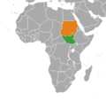
Fitxategi:South Sudan Sudan Locator-cropped.png

Aurreikuspen honen neurria: 528 × 600 pixel. Bestelako bereizmenak: 211 × 240 pixel | 422 × 480 pixel | 720 × 818 pixel.
Bereizmen handikoa ((720 × 818 pixel, fitxategiaren tamaina: 42 KB, MIME mota: image/png))
Fitxategiaren historia
Data/orduan klik egin fitxategiak orduan zuen itxura ikusteko.
| Data/Ordua | Iruditxoa | Neurriak | Erabiltzailea | Iruzkina | |
|---|---|---|---|---|---|
| oraingoa | 01:37, 29 abendua 2020 |  | 720 × 818 (42 KB) | Aquintero82 | Updated map |
| 06:34, 30 iraila 2016 |  | 380 × 360 (13 KB) | OgreBot | (BOT): Reverting to most recent version before archival | |
| 06:34, 30 iraila 2016 |  | 380 × 360 (13 KB) | OgreBot | (BOT): Uploading old version of file from en.wikipedia; originally uploaded on 2011-08-11 03:29:45 by Spesh531 | |
| 06:34, 30 iraila 2016 |  | 332 × 355 (11 KB) | OgreBot | (BOT): Uploading old version of file from en.wikipedia; originally uploaded on 2011-07-11 00:47:06 by Phoenix B 1of3 | |
| 14:09, 28 iraila 2016 |  | 380 × 360 (13 KB) | XXN | == Licensing == {{self|cc-zero}} Category:Bilateral maps of Category:Bilateral maps of |
Irudira dakarten loturak
Hurrengo orrialdeek dute fitxategi honetarako lotura:
Fitxategiaren erabilera orokorra
Hurrengo beste wikiek fitxategi hau darabilte:
- ar.wikipedia.org proiektuan duen erabilera
- en.wikipedia.org proiektuan duen erabilera
- es.wikipedia.org proiektuan duen erabilera
- he.wikipedia.org proiektuan duen erabilera
- it.wikipedia.org proiektuan duen erabilera
- pl.wikipedia.org proiektuan duen erabilera
- pt.wikipedia.org proiektuan duen erabilera
- ru.wikipedia.org proiektuan duen erabilera
- www.wikidata.org proiektuan duen erabilera
- zh.wikipedia.org proiektuan duen erabilera
