Fitxategi:Russland 6FK ural map.png

Aurreikuspen honen neurria: 547 × 600 pixel. Bestelako bereizmenak: 219 × 240 pixel | 438 × 480 pixel | 700 × 768 pixel | 1.161 × 1.273 pixel.
Bereizmen handikoa ((1.161 × 1.273 pixel, fitxategiaren tamaina: 84 KB, MIME mota: image/png))
Fitxategi hau Wikimedia Commonsekoa da. Hango deskribapen orriko informazioa behean duzu. |
| Deskribapena |
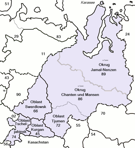
Map of Russia with merged subjects (01.01.2008, last merger Irkutskaya oblast+Ust-Orda Buryat autonomous district.) The subjects are grouped and tagged with their respective ISO 3166-2:RU code for easy creation of derivative maps. |
| Data | (UTC) |
| Jatorria | |
| Egilea |
|
| This is a retouched picture, which means that it has been digitally altered from its original version. Modifications: change colors and add names and numbers. The original can be viewed here: Map of Russian subjects recent.svg:
|
Nik, lan honen egileak, argitaratzen dut ondorengo lizentzia hauen pean:
Fitxategi hau Creative Commons Aitorpena 2.5 Generikoa lizentziapean dago.
- Askea zara:
- partekatzeko – lana kopiatzeko, banatzeko eta bidaltzeko
- birnahasteko – lana moldatzeko
- Ondorengo baldintzen pean:
- eskuduntza – Egiletza behar bezala aitortu behar duzu, lizentzia ikusteko esteka gehitu, eta ea aldaketak egin diren aipatu. Era egokian egin behar duzu hori guztia, baina inola ere ez egileak zure lana edo zure erabilera babesten duela irudikatuz.
Nahiago duzun lizentzia erabil dezakezu.
Jatorrizko igoera erregistroa
This image is a derivative work of the following images:
- File:Map_of_Russian_subjects_recent.svg licensed with Cc-by-2.5, Cc-by-2.5
- 2008-01-17T03:29:40Z Lokal Profil 1092x630 (226515 Bytes) Fixed Chita/Agin-Buryat. Also code cleanup and ID-tagged according to [[:en:ISO 3166-2:RU]]
- 2008-01-03T22:12:01Z Fremantleboy 1092x630 (195867 Bytes)
- 2007-05-24T12:57:17Z Fremantleboy 1092x630 (189700 Bytes) == Beschreibung == {{Information |Description=Map of Russia with merged subjects (01.07.2007) |Source=own work - selbst erstellt |Date=24. May 2007 - 24. Mai 2007 |Author=[[user:fremantleboy]] |Permission= |other
- 2007-05-24T12:39:34Z Fremantleboy 1092x630 (189547 Bytes) == Beschreibung == {{Information |Description=Map of Russia with merged subjects (01.07.2007) |Source=own work - selbst erstellt |Date=24. May 2007 - 24. Mai 2007 |Author=[[user:fremantleboy]] |Permission= |other
Uploaded with derivativeFX
Fitxategiaren historia
Data/orduan klik egin fitxategiak orduan zuen itxura ikusteko.
| Data/Ordua | Iruditxoa | Neurriak | Erabiltzailea | Iruzkina | |
|---|---|---|---|---|---|
| oraingoa | 11:16, 12 otsaila 2009 | | 1.161 × 1.273 (84 KB) | Loki de | map file now indexed and interleaced, save file size |
| 16:40, 11 otsaila 2009 |  | 1.161 × 1.273 (170 KB) | Loki de | {{Information |Description=Map of Russia with merged subjects (01.01.2008, last merger Irkutskaya oblast+Ust-Orda Buryat autonomous district.)<br> The subjects are grouped and tagged with their respec |
Irudira dakarten loturak
Hurrengo orrialdeek dute fitxategi honetarako lotura:
Fitxategiaren erabilera orokorra
Hurrengo beste wikiek fitxategi hau darabilte:
- ar.wikipedia.org proiektuan duen erabilera
- az.wikipedia.org proiektuan duen erabilera
- ca.wikipedia.org proiektuan duen erabilera
- cs.wikipedia.org proiektuan duen erabilera
- cy.wikipedia.org proiektuan duen erabilera
- eo.wikipedia.org proiektuan duen erabilera
- fi.wikipedia.org proiektuan duen erabilera
- frr.wikipedia.org proiektuan duen erabilera
- he.wikipedia.org proiektuan duen erabilera
- lv.wikipedia.org proiektuan duen erabilera
- no.wikipedia.org proiektuan duen erabilera
- pfl.wikipedia.org proiektuan duen erabilera
- pl.wikipedia.org proiektuan duen erabilera
- ps.wikipedia.org proiektuan duen erabilera
- ro.wikipedia.org proiektuan duen erabilera
- ru.wikinews.org proiektuan duen erabilera
- sr.wikipedia.org proiektuan duen erabilera
- uk.wikipedia.org proiektuan duen erabilera
- www.wikidata.org proiektuan duen erabilera