Fitxategi:Roma Plan.jpg

Aurreikuspen honen neurria: 754 × 600 pixel. Bestelako bereizmenak: 302 × 240 pixel | 604 × 480 pixel | 966 × 768 pixel | 1.280 × 1.018 pixel | 1.840 × 1.463 pixel.
Bereizmen handikoa ((1.840 × 1.463 pixel, fitxategiaren tamaina: 2,5 MB, MIME mota: image/jpeg))
Fitxategiaren historia
Data/orduan klik egin fitxategiak orduan zuen itxura ikusteko.
| Data/Ordua | Iruditxoa | Neurriak | Erabiltzailea | Iruzkina | |
|---|---|---|---|---|---|
| oraingoa | 18:14, 30 martxoa 2015 |  | 1.840 × 1.463 (2,5 MB) | Jonstevn | Reverted to version as of 19:01, 28 August 2006 |
| 18:10, 30 martxoa 2015 |  | 1.840 × 1.463 (2,5 MB) | Jonstevn | Reverted to version as of 19:01, 28 August 2006 | |
| 18:10, 30 martxoa 2015 |  | 1.840 × 1.463 (2,5 MB) | Jonstevn | Reverted to version as of 19:01, 28 August 2006 | |
| 08:40, 27 uztaila 2008 |  | 1.840 × 1.463 (3,38 MB) | Amadscientist | {{Information |Description= |Source= |Date= |Author= |Permission= |other_versions= }} | |
| 06:57, 27 uztaila 2008 |  | 4.000 × 3.180 (12,21 MB) | Amadscientist | {{Information |Description= |Source= |Date= |Author= |Permission= |other_versions= }} | |
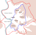
| 21:01, 28 abuztua 2006 |  | 1.840 × 1.463 (2,5 MB) | Nikephoros | {{Information |Description=Plan Roms im Altertum / Map of Rome during Antiquity |Source=G. Droysens Allgemeiner Historischer Handatlas |Date=1886 |Author=? |Permission= not needed |other_versions= no }} |
Irudira dakarten loturak
Hurrengo orrialdeek dute fitxategi honetarako lotura:
Fitxategiaren erabilera orokorra
Hurrengo beste wikiek fitxategi hau darabilte:
- ar.wikipedia.org proiektuan duen erabilera
- as.wikipedia.org proiektuan duen erabilera
- azb.wikipedia.org proiektuan duen erabilera
- beta.wikiversity.org proiektuan duen erabilera
- bg.wikipedia.org proiektuan duen erabilera
- bn.wikipedia.org proiektuan duen erabilera
- bs.wikipedia.org proiektuan duen erabilera
- bxr.wikipedia.org proiektuan duen erabilera
- ca.wikipedia.org proiektuan duen erabilera
- ceb.wikipedia.org proiektuan duen erabilera
- cs.wikipedia.org proiektuan duen erabilera
Ikus fitxategi honen erabilpen global gehiago.


