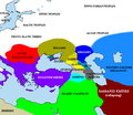
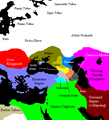
Fitxategi:Pontic steppe region around 650 AD.png
Pontic_steppe_region_around_650_AD.png ((637 × 553 pixel, fitxategiaren tamaina: 40 KB, MIME mota: image/png))
Fitxategiaren historia
Data/orduan klik egin fitxategiak orduan zuen itxura ikusteko.
| Data/Ordua | Iruditxoa | Neurriak | Erabiltzailea | Iruzkina | |
|---|---|---|---|---|---|
| oraingoa | 19:35, 14 urria 2022 |  | 637 × 553 (40 KB) | Gyalu22 | The Byzantine and Sassanian empires were under invasion |
| 22:33, 24 otsaila 2016 |  | 637 × 553 (53 KB) | Taron Saharyan | Армения был автономна, см. Theodore Rshtuni | |
| 15:35, 23 abendua 2015 |  | 637 × 553 (51 KB) | Ercwlff | for 650 armenia was already conquered by the arabs | |
| 13:08, 25 iraila 2015 |  | 637 × 553 (53 KB) | Taron Saharyan | исправлены восточные пределы Армении | |
| 13:10, 10 abuztua 2014 |  | 637 × 553 (40 KB) | Spiridon Ion Cepleanu | Cosmetic little changes according with H.E.Stier (dir.) « Westermann Grosser Atlas zur Weltgeschichte », 1985, ISBN 3-14-100919-8, the « Putzger historischer Weltatlas Cornelsen » 1990, ISBN 3-464-00176-8, the André & Jean Sellier « Atlas des Peu... | |
| 12:43, 25 maiatza 2007 |  | 637 × 553 (27 KB) | Angusmclellan | {{Information |Description=The en:Pontic steppe region, c. AD 650. en:Category:Historical maps by User:Briangotts en:Category:Maps of the history of Russia |Source=Originally from [http://en.wikipedia.org en.wikipedia]; description page | |
| 10:44, 17 urtarrila 2006 |  | 406 × 448 (15 KB) | Jrohr | == Summary == The Pontic steppe region, c. 650 CE. Category:Historical maps by User:Briangotts == Licensing == {{GFDL-self}} |
Irudira dakarten loturak
Hurrengo orrialdeek dute fitxategi honetarako lotura:
Fitxategiaren erabilera orokorra
Hurrengo beste wikiek fitxategi hau darabilte:
- af.wikipedia.org proiektuan duen erabilera
- ar.wikipedia.org proiektuan duen erabilera
- azb.wikipedia.org proiektuan duen erabilera
- az.wikipedia.org proiektuan duen erabilera
- ba.wikipedia.org proiektuan duen erabilera
- be.wikipedia.org proiektuan duen erabilera
- bg.wikipedia.org proiektuan duen erabilera
- ca.wikipedia.org proiektuan duen erabilera
- cs.wikipedia.org proiektuan duen erabilera
- cu.wikipedia.org proiektuan duen erabilera
- cv.wikipedia.org proiektuan duen erabilera
- da.wikipedia.org proiektuan duen erabilera
- de.wikipedia.org proiektuan duen erabilera
- de.wikibooks.org proiektuan duen erabilera
- de.wikiversity.org proiektuan duen erabilera
- el.wikipedia.org proiektuan duen erabilera
- en.wikipedia.org proiektuan duen erabilera
- eo.wikipedia.org proiektuan duen erabilera
- es.wikipedia.org proiektuan duen erabilera
- fa.wikipedia.org proiektuan duen erabilera
- fi.wikipedia.org proiektuan duen erabilera
- fr.wikipedia.org proiektuan duen erabilera
Ikus fitxategi honen erabilpen global gehiago.


