Fitxategi:Occitania map (1).png

Aurreikuspen honen neurria: 800 × 531 pixel. Bestelako bereizmenak: 320 × 212 pixel | 640 × 425 pixel | 1.024 × 679 pixel | 1.435 × 952 pixel.
Bereizmen handikoa ((1.435 × 952 pixel, fitxategiaren tamaina: 313 KB, MIME mota: image/png))
Fitxategi hau Wikimedia Commonsekoa da. Hango deskribapen orriko informazioa behean duzu. |
.png)
Laburpena
| Deskribapena |
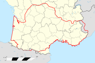
Occitan : Mapa d'Occitània facha per Cedric31 26 d'oct de 2008 a 11:33 (UTC) a partir de |
| Data | 2008ko urriaren 26a (Jatorrizko igoera-data) |
| Jatorria | Transferred from oc.wikipedia to Commons. |
| Egilea | The original uploader was Cedric31 at okzitaniera Wikipedia. |
Lizentzia
This file is licensed under the Creative Commons Attribution-Share Alike 2.5 Generic license.
- Askea zara:
- partekatzeko – lana kopiatzeko, banatzeko eta bidaltzeko
- birnahasteko – lana moldatzeko
- Ondorengo baldintzen pean:
- eskuduntza – Egiletza behar bezala aitortu behar duzu, lizentzia ikusteko esteka gehitu, eta ea aldaketak egin diren aipatu. Era egokian egin behar duzu hori guztia, baina inola ere ez egileak zure lana edo zure erabilera babesten duela irudikatuz.
- berdin partekatu – Lan honetan oinarrituta edo aldatuta berria eraikitzen baduzu, emaitza lana hau bezalako lizentzia batekin argitaratu behar duzu.
Jatorrizko igoera erregistroa
The original description page was here. All following user names refer to oc.wikipedia.
| Data/Ordua | Neurriak | Erabiltzailea | Iruzkina |
|---|---|---|---|
| 2008-10-26 11:33 | 448×299× (56108 bytes) | Cedric31 | Mapa d'Occitània facha per ~~~~ a partir de [[:Image:France location map-Regions and departements.svg]] |
Fitxategiaren historia
Data/orduan klik egin fitxategiak orduan zuen itxura ikusteko.
| Data/Ordua | Iruditxoa | Neurriak | Erabiltzailea | Iruzkina | |
|---|---|---|---|---|---|
| oraingoa | 08:51, 15 ekaina 2016 | | 1.435 × 952 (313 KB) | GosGroc | Límits d'Occitània en vermell gruixut. |
| 11:18, 11 ekaina 2016 |  | 1.435 × 952 (311 KB) | GosGroc | New region borders and legend. 2016 | |
| 18:07, 15 iraila 2015 |  | 448 × 299 (55 KB) | Toislex | Transferred from oc.wikipedia |
Irudira dakarten loturak
Hurrengo orrialdeek dute fitxategi honetarako lotura:
Fitxategiaren erabilera orokorra
Hurrengo beste wikiek fitxategi hau darabilte:
- oc.wikipedia.org proiektuan duen erabilera
- Limòtges
- Sent Iriès
- Solenhac
- Lo Vijan
- Cosés
- Isla (Nauta Vinhana)
- Lu Palaiç
- Aurèlh
- Festiac
- Panasòu
- Sent Just (Lemosin)
- Pau
- Baiona
- Auloron
- Lengon
- L'Esparra
- Liborna
- Dacs
- Agen
- Vilanuèva d'Òut
- Marmanda
- Nerac
- Aush
- Condòm
- Miranda (Gers)
- Sent Gaudenç
- Murèth
- Tarba
- Argelèrs de Gasòst
- Vichèi
- Privàs
- L'Argentèira
- Tornon (Vivarés)
- Rodés
- Milhau
- Vilafranca de Roergue
- Carcassona
- Narbona
- Limós
- Gap
- Briançon
- Barcilona (Provença)
- Castelana
- Niça
- Marselha
- Ais
- Istre
- Arle
- Fois
- Sent Gironç
Ikus fitxategi honen erabilpen global gehiago.
.png)
.png)