Fitxategi:North America second level political division 2.svg

Bereizmen handikoa(SVG fitxategia, nominaldi 512 × 596 pixel, fitxategiaren tamaina: 132 KB)

Fitxategi hau Wikimedia Commonsekoa da. Hango deskribapen orriko informazioa behean duzu.
Commons gordailu bat da, lizentzia askea duten multimedia fitxategiena. Lagun dezakezu.

Fitxategi hau Wikimedia Commonsekoa da

Laburpena

Deskribapena
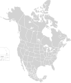
English: Map of North America and its second-level political divisions. Canadian provinces, US and Mexican states. Canada, Mexico, United States.

Non-contiguous parts of a states/provinces are "grouped" together with the main area of the state/provinces, so any state/provinces can be coloured in completion with one click anywhere on the state/provinces's area.

Also, all states/provinces have a "id" attached to them, making them easy to find. Select "find" and then enter in the state/provinces's ISO 3166-2 code in the "id" field to find it. The codes can be found here (Canada), here (USA) and here (Mexico).
Data
Jatorria

Canada and US map: BlankMap-USA-states-Canada-provinces, HI closer.svg by Lokal_Profil.
Mexico map: Mexico template.svg by Mario Fuente Cid
Combined by Alex Covarrubias.

 
SVG irudi honen iturburu kodea baliozkoa.
 
This vector image was created with Inkscape, and then manually edited
.
 
W3C-validity not checked.
Egilea Alex Covarrubias
Lizentzia
(Fitxategi hau berrerabiltzen)
w:eu:Creative Commons
eskuduntza berdin partekatu
This file is licensed under the Creative Commons Attribution-Share Alike 2.5 Generic license.
Askea zara:
  • partekatzeko – lana kopiatzeko, banatzeko eta bidaltzeko
  • birnahasteko – lana moldatzeko
Ondorengo baldintzen pean:
  • eskuduntza – Egiletza behar bezala aitortu behar duzu, lizentzia ikusteko esteka gehitu, eta ea aldaketak egin diren aipatu. Era egokian egin behar duzu hori guztia, baina inola ere ez egileak zure lana edo zure erabilera babesten duela irudikatuz.
  • berdin partekatu – Lan honetan oinarrituta edo aldatuta berria eraikitzen baduzu, emaitza lana hau bezalako lizentzia batekin argitaratu behar duzu.
Beste bertsioak

Derivative works of this file:

Irudi-oineko testuak

Add a one-line explanation of what this file represents

Fitxategi honetan agertzen diren itemak

honako hau irudikatzen du

7 urria 2007

Fitxategiaren historia

Data/orduan klik egin fitxategiak orduan zuen itxura ikusteko.

Data/OrduaIruditxoaNeurriakErabiltzaileaIruzkina
oraingoa03:51, 23 azaroa 202003:51, 23 azaroa 2020 bertsioaren iruditxoa512 × 596 (132 KB)Ponderosapine210Added the prominent islands of Manitoulin (Ontario) and Isle Royale (Michigan) to the Great Lakes.
01:07, 2 ekaina 201901:07, 2 ekaina 2019 bertsioaren iruditxoa512 × 596 (130 KB)Fluffy89502added territories, made DC visible, adjusted mexican borders
14:23, 4 apirila 201414:23, 4 apirila 2014 bertsioaren iruditxoa1.712 × 1.992 (270 KB)Lommesmade the borders between the mexican subdivisions the same size as their canadian / us counterparts.
01:23, 9 abendua 200701:23, 9 abendua 2007 bertsioaren iruditxoa1.712 × 1.992 (327 KB)Lokal ProfilCode cleanup
09:55, 7 urria 200709:55, 7 urria 2007 bertsioaren iruditxoa1.712 × 1.992 (342 KB)AlexCovarrubias== Summary == {{Information |Description=Map of North America and its second-level political divisions. Canadian provinces, US and Mexican states. Canada, Mexico, United States. |Source=Canada and US map by Alan Rockefeller. Mexico map by Alex Covarrubias

Ez dago fitxategi hau darabilen orririk.

Fitxategiaren erabilera orokorra

Metadatuak