Fitxategi:NPS pinnacles-map.jpg

Aurreikuspen honen neurria: 461 × 599 pixel. Bestelako bereizmenak: 185 × 240 pixel | 369 × 480 pixel | 591 × 768 pixel | 788 × 1.024 pixel | 1.862 × 2.420 pixel.
Bereizmen handikoa ((1.862 × 2.420 pixel, fitxategiaren tamaina: 600 KB, MIME mota: image/jpeg))
Fitxategi hau Wikimedia Commonsekoa da. Hango deskribapen orriko informazioa behean duzu. |
Laburpena
| Deskribapena |
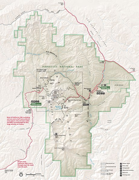
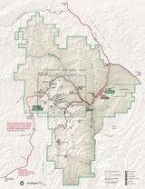
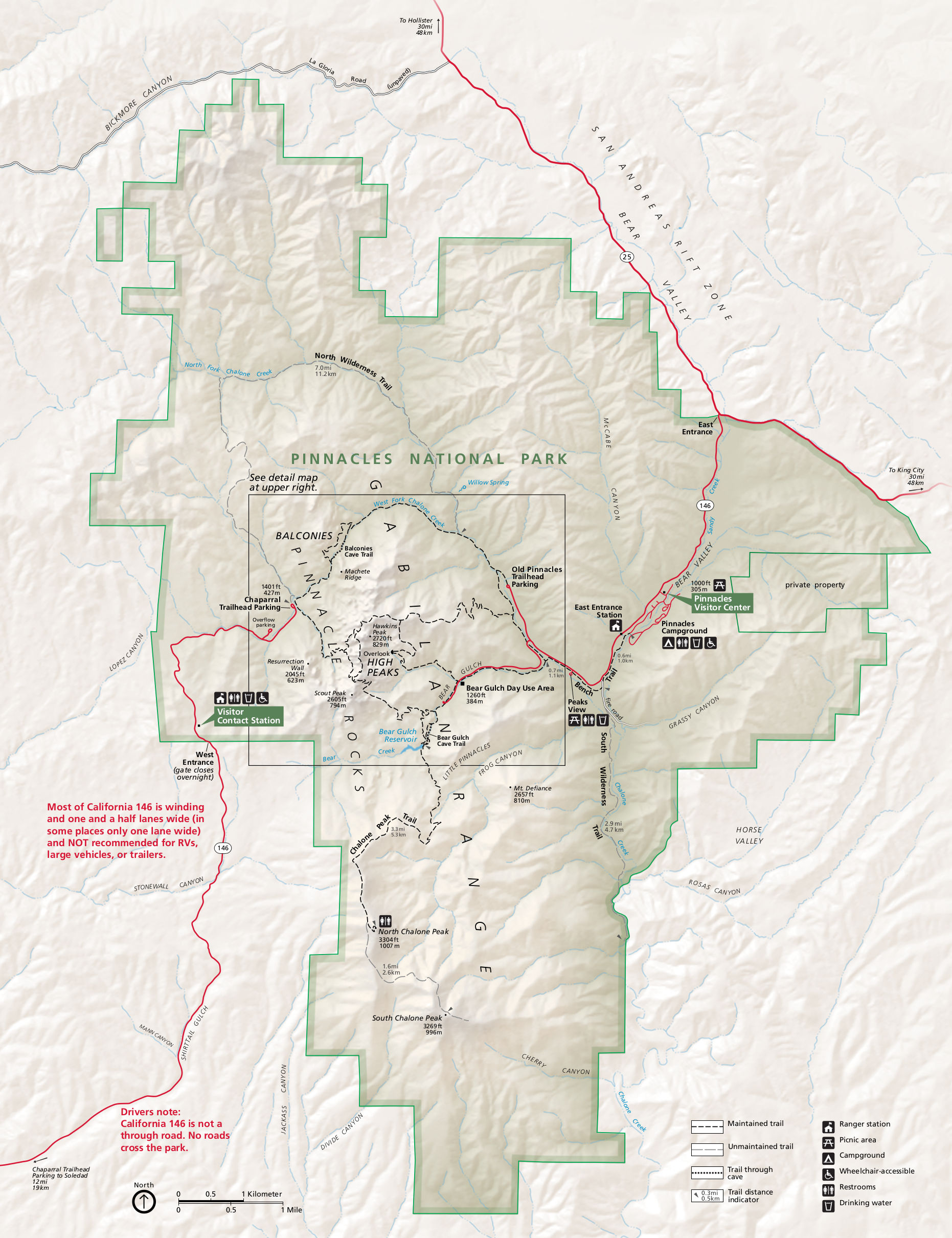
English: Main Pinnacles National Park map, showing roads, hiking trails, campgrounds, visitor centers, and points of interest. |
| Data | |
| Jatorria | U.S. National Park Service (http://npmaps.com/wp-content/uploads/pinnacles-map.jpg) |
| Egilea | U.S. National Park Service, restoration/cleanup by Matt Holly |
| Beste bertsioak |
 |
Lizentzia
| This image or media file contains material based on a work of a National Park Service employee, created as part of that person's official duties. As a work of the U.S. federal government, such work is in the public domain in the United States. See the NPS website and NPS copyright policy for more information. |
Fitxategiaren historia
Data/orduan klik egin fitxategiak orduan zuen itxura ikusteko.
| Data/Ordua | Iruditxoa | Neurriak | Erabiltzailea | Iruzkina | |
|---|---|---|---|---|---|
| oraingoa | 03:52, 17 maiatza 2017 | | 1.862 × 2.420 (600 KB) | RKBot | =={{int:filedesc}}== {{Information |description= {{en|1=Main Pinnacles National Park map, showing roads, hiking trails, campgrounds, visitor centers, and points of interest.}} |date= 2015-08-14 |source= U.S. National Park Service (http://npmaps.com/wp-... |
Irudira dakarten loturak
Hurrengo orrialdeek dute fitxategi honetarako lotura:
Fitxategiaren erabilera orokorra
Hurrengo beste wikiek fitxategi hau darabilte:
- en.wikipedia.org proiektuan duen erabilera
- es.wikipedia.org proiektuan duen erabilera
- he.wikipedia.org proiektuan duen erabilera
- nl.wikipedia.org proiektuan duen erabilera
- pl.wikipedia.org proiektuan duen erabilera
- tr.wikipedia.org proiektuan duen erabilera