Fitxategi:Map indicating Victoria Island, northern Canada.png
Map_indicating_Victoria_Island,_northern_Canada.png ((428 × 380 pixel, fitxategiaren tamaina: 67 KB, MIME mota: image/png))
Fitxategi hau Wikimedia Commonsekoa da. Hango deskribapen orriko informazioa behean duzu. |
Laburpena
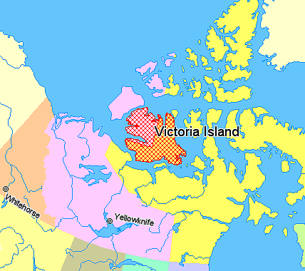
Map indicating Victoria Island, northern Canada.
© Her Majesty the Queen in Right of Canada, Department of Natural Resources. All rights reserved.
Licence Agreement
Lizentzia

|
The copyright holder of this work allows anyone to use it for any purpose including unrestricted redistribution, commercial use, and modification.
Usage notes:
|
Fitxategiaren historia
Data/orduan klik egin fitxategiak orduan zuen itxura ikusteko.
| Data/Ordua | Iruditxoa | Neurriak | Erabiltzailea | Iruzkina | |
|---|---|---|---|---|---|
| oraingoa | 03:19, 21 martxoa 2006 | | 428 × 380 (67 KB) | David Kernow~commonswiki | Map indicating Victoria Island, northern Canada. {{legend|#ffff66|Nunavut}} {{legend|#ffccff|Northwest Territories}} {{legend|#ffcc99|Yukon Territory}} {{legend|#ffff99|British Columbia}} {{legend|#ffffcc|Regions outside Canada (Ala |
Irudira dakarten loturak
Hurrengo orrialdeek dute fitxategi honetarako lotura:
Fitxategiaren erabilera orokorra
Hurrengo beste wikiek fitxategi hau darabilte:
- es.wikipedia.org proiektuan duen erabilera
- fr.wikipedia.org proiektuan duen erabilera
- gl.wikipedia.org proiektuan duen erabilera
- it.wikipedia.org proiektuan duen erabilera
- pt.wikipedia.org proiektuan duen erabilera
- ro.wikipedia.org proiektuan duen erabilera