Fitxategi:LocationBritishVirginIslands.svg

SVG fitxategi honen PNG aurreikuspenaren tamaina: 800 × 320 pixel. Bestelako bereizmenak: 320 × 128 pixel | 640 × 256 pixel | 1.024 × 410 pixel | 1.280 × 512 pixel | 2.560 × 1.024 pixel | 1.750 × 700 pixel.
Bereizmen handikoa (SVG fitxategia, nominaldi 1.750 × 700 pixel, fitxategiaren tamaina: 324 KB)
Fitxategi hau Wikimedia Commonsekoa da. Hango deskribapen orriko informazioa behean duzu. |

|
A raster version of this image is available. It should be used in place of this vector image when superior.
File:LocationBritishVirginIslands.svg → File:LocationBritishVirginIslands.png
In general, it is better to use a good SVG version. |
Laburpena
| Deskribapena |
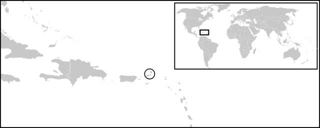
English: Location map for British Virgin Islands. Vectorised version of Image:LocationBritishVirginIslands.png |
| Data | (UTC) |
| Jatorria |
Fitxategi hau (bektore-irudia) hau Inkscape-ekin sortu da .
. |
| Egilea |
|
Lizentzia
| This is a retouched picture, which means that it has been digitally altered from its original version. Modifications: Combined two maps to form a newly vectorised version of the British Virgin Islands map. The original can be viewed here: BlankMap-Caribbean.svg:
|
| Nik, lan honen egile eskubideen jabeak, lan hau domeinu publikoan jartzen dut. Mundu osoan du eragina honek. Estatu batzuetan beharbada hori ez da legez posible izango. Halakoetan: Edonori ematen diot lan hau edozertarako erabiltzeko eskubidea, inolako baldintzarik gabe, legeak nahitaez ezarritako baldintzak izan ezik. |
Jatorrizko igoera erregistroa
This image is a derivative work of the following images:
- File:BlankMap-World-v2.svg licensed with PD-self
- 2011-03-27T23:08:42Z Wayiran 1243x564 (209452 Bytes) Some correction on North-west border of Iran's map + south of Caspian sea
- 2008-12-03T18:02:36Z Harbin 1326x601 (192122 Bytes)
- 2008-12-02T19:55:14Z Harbin 1326x601 (197882 Bytes)
- 2008-12-02T19:04:59Z Harbin 1326x601 (176022 Bytes) {{Information |Description={{en|1=A blank map of the world as of 2005, with country outlines. Sovereign microstates less than 2 500 km² in area are depicted as circles (see Wikipedia:Image_talk:BlankMap-World-v2.png for list
- File:BlankMap-Caribbean.svg licensed with PD-self
- 2010-09-20T02:01:50Z NuclearVacuum 896x633 (274735 Bytes) new version
- 2010-02-23T15:29:09Z NuclearVacuum 2201x1507 (214283 Bytes) cleanup
- 2010-02-11T19:26:10Z NuclearVacuum 2201x1507 (211807 Bytes) I have started from scratch and made a completely new map of the Caribbean. This current version has an invalid code, but I will work on that later.
- 2009-09-22T00:08:34Z NuclearVacuum 940x477 (252618 Bytes) {{Information |Description={{en|1=Map of the [[:en:Caribbean|Caribbean nations]].}} |Source=[[:File:BlankMap-World6.svg]]{{Inkscape}} |Author=[[User:NuclearVacuum|NuclearVacuum]] |Date=2009-09-21 |Permission= |other_versions=
Uploaded with derivativeFX
Fitxategiaren historia
Data/orduan klik egin fitxategiak orduan zuen itxura ikusteko.
| Data/Ordua | Iruditxoa | Neurriak | Erabiltzailea | Iruzkina | |
|---|---|---|---|---|---|
| oraingoa | 04:08, 30 ekaina 2011 | 1.750 × 700 (324 KB) | Maky | {{Bitmap version available|LocationBritishVirginIslands.png}} {{Information |Description={{en|1=Location map for British Virgin Islands.<br> Vectorised version of Image:LocationBritishVirginIslands.png}} |Source=*File:BlankMap-World-v2.svg |
Irudira dakarten loturak
Hurrengo orrialdeek dute fitxategi honetarako lotura:
Fitxategiaren erabilera orokorra
Hurrengo beste wikiek fitxategi hau darabilte:
- ceb.wikipedia.org proiektuan duen erabilera
- el.wikipedia.org proiektuan duen erabilera
- en.wikipedia.org proiektuan duen erabilera
- es.wikinews.org proiektuan duen erabilera
- fr.wikipedia.org proiektuan duen erabilera
- fr.wiktionary.org proiektuan duen erabilera
- gcr.wikipedia.org proiektuan duen erabilera
- ko.wikipedia.org proiektuan duen erabilera
- mk.wikipedia.org proiektuan duen erabilera
- pnb.wikipedia.org proiektuan duen erabilera
- ro.wikipedia.org proiektuan duen erabilera
- su.wikipedia.org proiektuan duen erabilera
- sv.wikipedia.org proiektuan duen erabilera
- vi.wikipedia.org proiektuan duen erabilera
- www.wikidata.org proiektuan duen erabilera