Fitxategi:Lage des Landkreises Maerkisch-Oderland in Deutschland.png
Lage_des_Landkreises_Maerkisch-Oderland_in_Deutschland.png ((176 × 234 pixel, fitxategiaren tamaina: 5 KB, MIME mota: image/png))
Fitxategi hau Wikimedia Commonsekoa da. Hango deskribapen orriko informazioa behean duzu. |
Laburpena
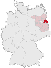
Karte erstellt auf der Grundlage der opengeodb.de-Umrisse.
Moved from de.wikipedia.org, first upload by de:Benutzer:Geograv.
Lizentzia
This image was generated with OpenGeoDB. The information there is placed in the public domain, images generated from OpenGeoDB are derivative works without passing the threshold of creativity, they are therefore also public domain.
| This work is ineligible for copyright and therefore in the public domain because it consists entirely of information that is common property and contains no original authorship. |
Fitxategiaren historia
Data/orduan klik egin fitxategiak orduan zuen itxura ikusteko.
| Data/Ordua | Iruditxoa | Neurriak | Erabiltzailea | Iruzkina | |
|---|---|---|---|---|---|
| oraingoa | 01:27, 18 ekaina 2006 | | 176 × 234 (5 KB) | Rauenstein | == Summary == Karte erstellt auf der Grundlage der opengeodb.de-Umrisse. Moved from de.wikipedia.org, first upload by de:Benutzer:Geograv. == License == {{GFDL-OpenGeoDB}} Category:Maps of Brandenburg |
Irudira dakarten loturak
Hurrengo orrialdeek dute fitxategi honetarako lotura:
Fitxategiaren erabilera orokorra
Hurrengo beste wikiek fitxategi hau darabilte:
- da.wikipedia.org proiektuan duen erabilera
- de.wikipedia.org proiektuan duen erabilera
- es.wikipedia.org proiektuan duen erabilera
- fr.wikipedia.org proiektuan duen erabilera
- hu.wikipedia.org proiektuan duen erabilera
- id.wikipedia.org proiektuan duen erabilera
- incubator.wikimedia.org proiektuan duen erabilera
- ka.wikipedia.org proiektuan duen erabilera
- ms.wikipedia.org proiektuan duen erabilera
- pl.wikipedia.org proiektuan duen erabilera
- sh.wikipedia.org proiektuan duen erabilera
- sr.wikipedia.org proiektuan duen erabilera
- sv.wikipedia.org proiektuan duen erabilera
- tt.wikipedia.org proiektuan duen erabilera
- uk.wikipedia.org proiektuan duen erabilera
- www.wikidata.org proiektuan duen erabilera
- zh.wikipedia.org proiektuan duen erabilera