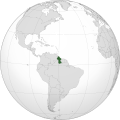
Fitxategi:GUY orthographic.svg

SVG fitxategi honen PNG aurreikuspenaren tamaina: 550 × 550 pixel. Bestelako bereizmenak: 240 × 240 pixel | 480 × 480 pixel | 768 × 768 pixel | 1.024 × 1.024 pixel | 2.048 × 2.048 pixel.
Bereizmen handikoa (SVG fitxategia, nominaldi 550 × 550 pixel, fitxategiaren tamaina: 1,1 MB)
Fitxategiaren historia
Data/orduan klik egin fitxategiak orduan zuen itxura ikusteko.
| Data/Ordua | Iruditxoa | Neurriak | Erabiltzailea | Iruzkina | |
|---|---|---|---|---|---|
| oraingoa | 18:02, 11 abendua 2023 |  | 550 × 550 (1,1 MB) | SOUTHCOM | Reverted to version as of 00:18, 3 April 2023 (UTC) Restore to normal version |
| 21:09, 10 abendua 2023 |  | 550 × 550 (1,22 MB) | PFSV-UY | Reverted to version as of 16:44, 1 April 2023 (UTC) (esté o no en lo correcto, es un territorio en disputa de cualquier manera) | |
| 02:18, 3 apirila 2023 |  | 550 × 550 (1,1 MB) | Chipmunkdavis | Reverted to version as of 08:00, 17 August 2022 (UTC) Restore to normal version | |
| 18:44, 1 apirila 2023 |  | 550 × 550 (1,22 MB) | Salvadoroff | Reverted to version as of 01:21, 17 August 2022 (UTC) | |
| 10:00, 17 abuztua 2022 |  | 550 × 550 (1,1 MB) | Chipmunkdavis | Reverted to version as of 21:45, 31 July 2022 (UTC) | |
| 03:21, 17 abuztua 2022 |  | 550 × 550 (1,22 MB) | Floppa Historico | No te cansas de justificar a guyana? | |
| 23:45, 31 uztaila 2022 |  | 550 × 550 (1,1 MB) | Chipmunkdavis | Reverted to version as of 15:14, 28 July 2022 (UTC) Again, light green is for uncontrolled claims. Please upload a separate file if you want something with a new convention system. | |
| 18:41, 28 uztaila 2022 |  | 550 × 550 (1,22 MB) | Floppa Historico | Guyana has claimed territories with Suriname and Venezuela. I think they should show up. | |
| 17:14, 28 uztaila 2022 |  | 550 × 550 (1,1 MB) | Chipmunkdavis | Reverted to version as of 06:44, 20 July 2022 (UTC) Rv, light green is for uncontrolled claims. | |
| 09:02, 24 uztaila 2022 |  | 550 × 550 (1,22 MB) | Floppa Historico | Guyana has claimed territories with Suriname and Venezuela. I think they should show up. |
Irudira dakarten loturak
Hurrengo orrialdeek dute fitxategi honetarako lotura:
Fitxategiaren erabilera orokorra
Hurrengo beste wikiek fitxategi hau darabilte:
- ar.wikipedia.org proiektuan duen erabilera
- غيانا
- مستخدم:جار الله/قائمة صور مقالات العلاقات الثنائية
- العلاقات الأمريكية الغيانية
- العلاقات الأنغولية الغيانية
- العلاقات الغيانية الكورية الجنوبية
- العلاقات الإريترية الغيانية
- العلاقات السويسرية الغيانية
- العلاقات الألمانية الغيانية
- العلاقات الغيانية الليختنشتانية
- العلاقات البوليفية الغيانية
- العلاقات الغيانية الموزمبيقية
- العلاقات الألبانية الغيانية
- العلاقات البلجيكية الغيانية
- العلاقات الإثيوبية الغيانية
- العلاقات البيلاروسية الغيانية
- العلاقات الطاجيكستانية الغيانية
- العلاقات الروسية الغيانية
- العلاقات الرومانية الغيانية
- العلاقات الأرجنتينية الغيانية
- العلاقات الغامبية الغيانية
- العلاقات الغيانية القبرصية
- العلاقات السيراليونية الغيانية
- العلاقات الغيانية النيبالية
- العلاقات الغيانية الليبيرية
- العلاقات التشيكية الغيانية
- العلاقات الغيانية الميانمارية
- العلاقات الغيانية الكندية
- العلاقات السعودية الغيانية
- العلاقات الإسرائيلية الغيانية
- العلاقات البالاوية الغيانية
- العلاقات الغيانية المالية
- العلاقات الغيانية النيجيرية
- العلاقات اليمنية الغيانية
- العلاقات الغيانية الفانواتية
- العلاقات الغابونية الغيانية
- العلاقات البنمية الغيانية
- العلاقات الغيانية الكوبية
- العلاقات الجورجية الغيانية
- العلاقات التونسية الغيانية
- العلاقات الغيانية الكورية الشمالية
- العلاقات الهندية الغيانية
- العلاقات اليابانية الغيانية
- العلاقات الإيطالية الغيانية
- العلاقات الغيانية الناوروية
- العلاقات الأسترالية الغيانية
- العلاقات الزامبية الغيانية
- العلاقات الغيانية الفيجية
- العلاقات المارشالية الغيانية
- العلاقات الأذربيجانية الغيانية
- العلاقات السودانية الغيانية
Ikus fitxategi honen erabilpen global gehiago.
