Fitxategi:Four color world map.svg

SVG fitxategi honen PNG aurreikuspenaren tamaina: 800 × 353 pixel. Bestelako bereizmenak: 320 × 141 pixel | 640 × 283 pixel | 1.024 × 452 pixel | 1.280 × 565 pixel | 2.560 × 1.130 pixel | 940 × 415 pixel.
Bereizmen handikoa (SVG fitxategia, nominaldi 940 × 415 pixel, fitxategiaren tamaina: 1,58 MB)
Fitxategi hau Wikimedia Commonsekoa da. Hango deskribapen orriko informazioa behean duzu. |
Laburpena
| Deskribapena |
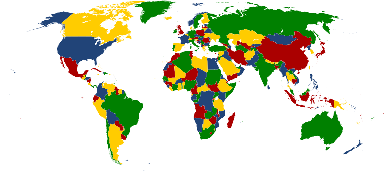
English: World map colored in green, yellow, blue and red to illustrate the four color theorem. This map considers just only land boundaries, although insular States have been colored too.
Español: Mapa del mundo coloreado de verde, amarillo, azul y rojo para ilustrar el teorema de los cuatro colores. El mapa considera únicamente los límites terrestres, si bien los Estados insulares también están coloreados. |
| Data | |
| Jatorria | Norberak egina, based on File:BlankMap-World6, compact.svg, uploaded by Lokal_Profil. |
| Egilea | XalD |
Lizentzia
| Nik, lan honen egile eskubideen jabeak, lan hau domeinu publikoan jartzen dut. Mundu osoan du eragina honek. Estatu batzuetan beharbada hori ez da legez posible izango. Halakoetan: Edonori ematen diot lan hau edozertarako erabiltzeko eskubidea, inolako baldintzarik gabe, legeak nahitaez ezarritako baldintzak izan ezik. |
Fitxategiaren historia
Data/orduan klik egin fitxategiak orduan zuen itxura ikusteko.
| Data/Ordua | Iruditxoa | Neurriak | Erabiltzailea | Iruzkina | |
|---|---|---|---|---|---|
| oraingoa | 00:24, 13 abuztua 2012 | | 940 × 415 (1,58 MB) | SiBr4 | Somehow Georgia disappeared... |
| 00:21, 13 abuztua 2012 |  | 940 × 415 (1,58 MB) | SiBr4 | Adding South Sudan | |
| 22:22, 29 abendua 2009 |  | 940 × 415 (1,57 MB) | XalD | {{Information |Description={{en|1=World map coloured of green, yellow, blue and red for illustrate the four color theorem. This map considers just only land boundaries, although insular States have been colored too.}} {{es|1=Map |
Irudira dakarten loturak
Hurrengo orrialdeek dute fitxategi honetarako lotura:
Fitxategiaren erabilera orokorra
Hurrengo beste wikiek fitxategi hau darabilte:
- ca.wikipedia.org proiektuan duen erabilera
- de.wikiversity.org proiektuan duen erabilera
- en.wikipedia.org proiektuan duen erabilera
- es.wikipedia.org proiektuan duen erabilera