Fitxategi:Falkland Islands location map.svg

SVG fitxategi honen PNG aurreikuspenaren tamaina: 737 × 600 pixel. Bestelako bereizmenak: 295 × 240 pixel | 590 × 480 pixel | 944 × 768 pixel | 1.258 × 1.024 pixel | 2.516 × 2.048 pixel | 1.134 × 923 pixel.
Bereizmen handikoa (SVG fitxategia, nominaldi 1.134 × 923 pixel, fitxategiaren tamaina: 138 KB)
Fitxategi hau Wikimedia Commonsekoa da. Hango deskribapen orriko informazioa behean duzu. |
Laburpena
| Deskripzio |
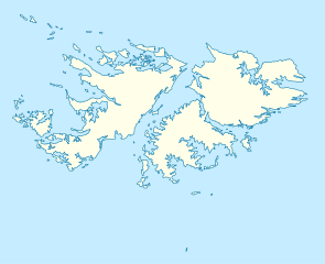
Deutsch: Positionskarte der Falklandinseln
Quadratische Plattkarte, N-S-Streckung 155 %. Geographische Begrenzung der Karte:
English: Location map of the Falkland Islands
Equirectangular projection, N/S stretching 155 %. Geographic limits of the map:
|
|||||||||
| Data | ||||||||||
| Jatorria | own work, using United States National Imagery and Mapping Agency data | |||||||||
| Sortzailea | ||||||||||
| Geotemporal data | ||||||||||
| Bounding box |
|
|||||||||
| Georeferencing | If inappropriate please set warp_status = skip to hide. | |||||||||
| Beste bertsioak |
Derivative works of this file: |
|||||||||

|
This map has been made or improved in the German Kartenwerkstatt (Map Lab). You can propose maps to improve as well.
|
Lizentzia
Nik, lan honen egileak, argitaratzen dut ondorengo lizentzia hauen pean:

|
Baimena duzu dokumentu hau kopiatu, banatu edo/eta aldatzeko GNU Free Documentation License baldintzapean, Free Software Foundationek argitaratutako 1.2 edo ondorengo bertsioan; sekzio aldaezinik gabe, azaleko testurik gabe, eta atzeko azaleko testurik gabe. Lizentziaren kopia dago GNU Free Documentation License izenburudun atalean. |
Fitxategi hau Creative Commons Aitortu 3.0 Unported lizentziaren mende dago.
- Askea zara:
- partekatzeko – lana kopiatzeko, banatzeko eta bidaltzeko
- birnahasteko – lana moldatzeko
- Ondorengo baldintzen pean:
- eskuduntza – Egiletza behar bezala aitortu behar duzu, lizentzia ikusteko esteka gehitu, eta ea aldaketak egin diren aipatu. Era egokian egin behar duzu hori guztia, baina inola ere ez egileak zure lana edo zure erabilera babesten duela irudikatuz.
Nahiago duzun lizentzia erabil dezakezu.
Fitxategiaren historia
Data/orduan klik egin fitxategiak orduan zuen itxura ikusteko.
| Data/Ordua | Iruditxoa | Neurriak | Erabiltzailea | Iruzkina | |
|---|---|---|---|---|---|
| oraingoa | 14:00, 15 martxoa 2009 | | 1.134 × 923 (138 KB) | NordNordWest | {{Information |Description= {{de|Positionskarte der Falklandinseln}} Quadratische Plattkarte, N-S-Streckung 155 %. Geographische Begrenzung der Karte: * N: 50.9° S * S: 53.0° S * W: 61.5° W * O: 57.5° W {{en|Location map of the |
Irudira dakarten loturak
Hurrengo orrialdeek dute fitxategi honetarako lotura:
Fitxategiaren erabilera orokorra
Hurrengo beste wikiek fitxategi hau darabilte:
- af.wikipedia.org proiektuan duen erabilera
- an.wikipedia.org proiektuan duen erabilera
- ar.wikipedia.org proiektuan duen erabilera
- ast.wikipedia.org proiektuan duen erabilera
- az.wikipedia.org proiektuan duen erabilera
- ba.wikipedia.org proiektuan duen erabilera
- be-tarask.wikipedia.org proiektuan duen erabilera
- be.wikipedia.org proiektuan duen erabilera
- bg.wikipedia.org proiektuan duen erabilera
- bn.wikipedia.org proiektuan duen erabilera
- ca.wikipedia.org proiektuan duen erabilera
- ceb.wikipedia.org proiektuan duen erabilera
- Plantilya:Location map United Kingdom Falkland Islands
- William Point
- Sandy Island
- Saddle Hill
- Rat Island
- Rabbit Island
- Low Bay
- Long Island
- Green Island
- Green Islet
- Goat Point
- Castle Hill
- Bird Island
- Mount Pleasant
- North Point
- Hospital Point
- Castle Rock
- West Point
- Little Island
- Black Point
- North Beach
- Sail Rock
- Black Rock
- High Rock
- Hut Point
- East Point
- Wolf Rock
- White Rock
- White Point
- Whale Point
Ikus fitxategi honen erabilpen global gehiago.