Fitxategi:Euskal Herriko mapa koloreztatua.png

Aurreikuspen honen neurria: 710 × 600 pixel. Bestelako bereizmenak: 284 × 240 pixel | 568 × 480 pixel | 909 × 768 pixel | 1.212 × 1.024 pixel | 2.000 × 1.690 pixel.
Bereizmen handikoa ((2.000 × 1.690 pixel, fitxategiaren tamaina: 137 KB, MIME mota: image/png))
Fitxategi hau Wikimedia Commonsekoa da. Hango deskribapen orriko informazioa behean duzu. |
Laburpena
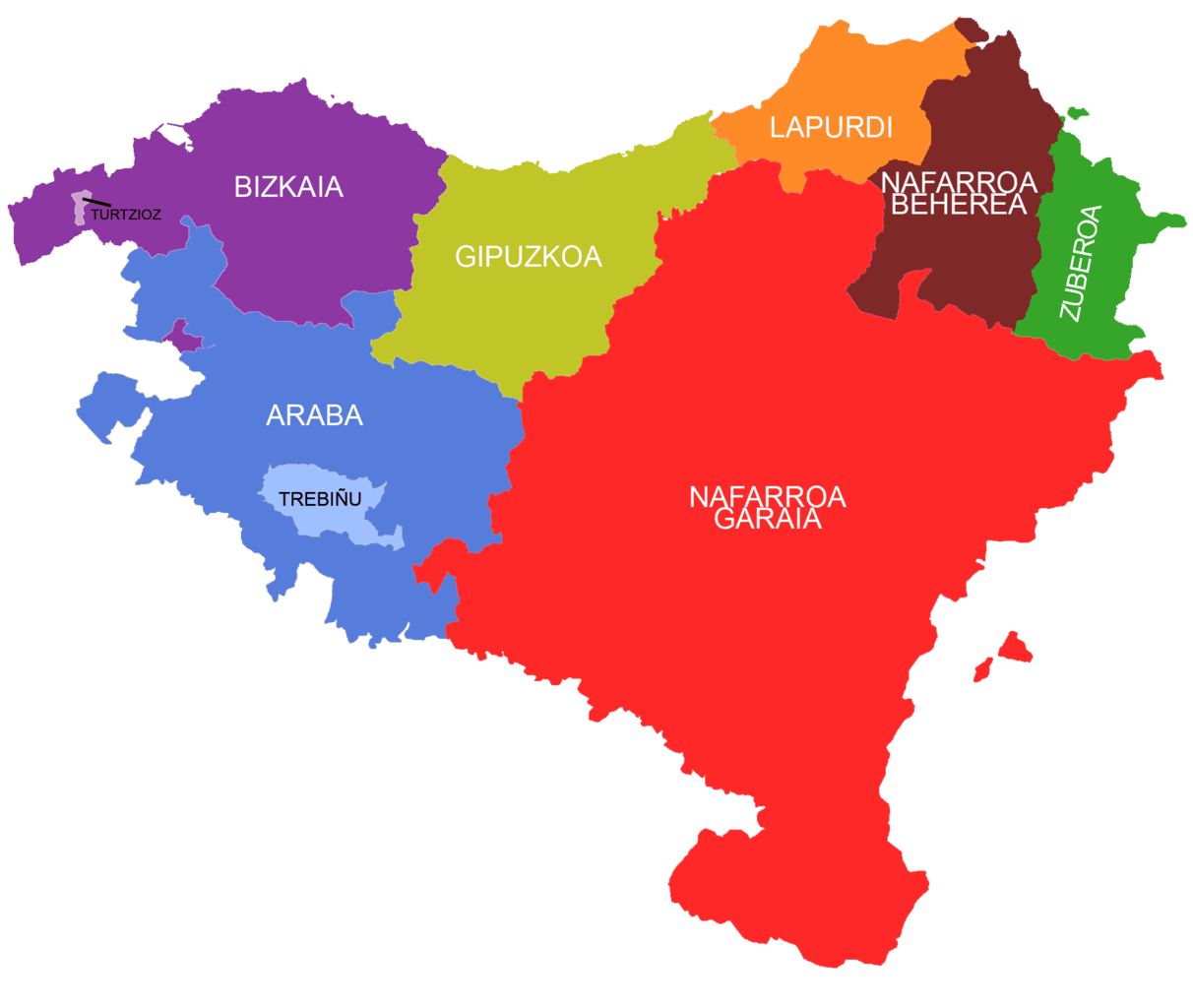
| Deskribapena | Coloured map of the historic Basque Country |
| Data | |
| Jatorria | Norberak egina |
| Egilea | Theklan |
| Lizentzia (Fitxategi hau berrerabiltzen) |
CC-BY-SA |
Lizentzia
Nik, lan honen egileak, argitaratzen dut ondorengo lizentzia hauen pean:

|
Baimena duzu dokumentu hau kopiatu, banatu edo/eta aldatzeko GNU Free Documentation License baldintzapean, Free Software Foundationek argitaratutako 1.2 edo ondorengo bertsioan; sekzio aldaezinik gabe, azaleko testurik gabe, eta atzeko azaleko testurik gabe. Lizentziaren kopia dago GNU Free Documentation License izenburudun atalean. |
Fitxategi hau Creative Commons Attribution-Share Alike 3.0 Unported lizentziapean dago.
- Askea zara:
- partekatzeko – lana kopiatzeko, banatzeko eta bidaltzeko
- birnahasteko – lana moldatzeko
- Ondorengo baldintzen pean:
- eskuduntza – Egiletza behar bezala aitortu behar duzu, lizentzia ikusteko esteka gehitu, eta ea aldaketak egin diren aipatu. Era egokian egin behar duzu hori guztia, baina inola ere ez egileak zure lana edo zure erabilera babesten duela irudikatuz.
- berdin partekatu – Lan honetan oinarrituta edo aldatuta berria eraikitzen baduzu, emaitza lana hau bezalako lizentzia batekin argitaratu behar duzu.
Nahiago duzun lizentzia erabil dezakezu.
Fitxategiaren historia
Data/orduan klik egin fitxategiak orduan zuen itxura ikusteko.
| Data/Ordua | Iruditxoa | Neurriak | Erabiltzailea | Iruzkina | |
|---|---|---|---|---|---|
| oraingoa | 12:45, 2 azaroa 2010 | | 2.000 × 1.690 (137 KB) | Havang(nl) | Lapurdi --> Zuberoa better colors |
| 20:42, 21 urtarrila 2008 |  | 2.000 × 1.690 (40 KB) | Theklan | == Summary == {{Information |Description= Coloured map of the Basque Country |Source=self-made |Date= 2008/01/11 |Author= Theklan |Permission= CC-BY-SA |other_versions= }} Category:Maps of the Basque Country | |
| 01:06, 11 urtarrila 2008 |  | 2.000 × 1.690 (40 KB) | Theklan | {{Information |Description= Coloured map of the Basque Country |Source=self-made |Date= 2008/01/11 |Author= Theklan |Permission= CC-BY-SA |other_versions= }} Category:Maps of the Basque Country |
Irudira dakarten loturak
Ez dago fitxategi hau darabilen orririk.
Fitxategiaren erabilera orokorra
Hurrengo beste wikiek fitxategi hau darabilte:
- es.wikipedia.org proiektuan duen erabilera
- it.wikipedia.org proiektuan duen erabilera
- pt.wikipedia.org proiektuan duen erabilera