Fitxategi:Dease and Simpson - Arctic expedition 1837.png

Bereizmen handikoa ((2.395 × 1.414 pixel, fitxategiaren tamaina: 288 KB, MIME mota: image/png))
Fitxategi hau Wikimedia Commonsekoa da. Hango deskribapen orriko informazioa behean duzu. |
Laburpena
| Deskribapena |
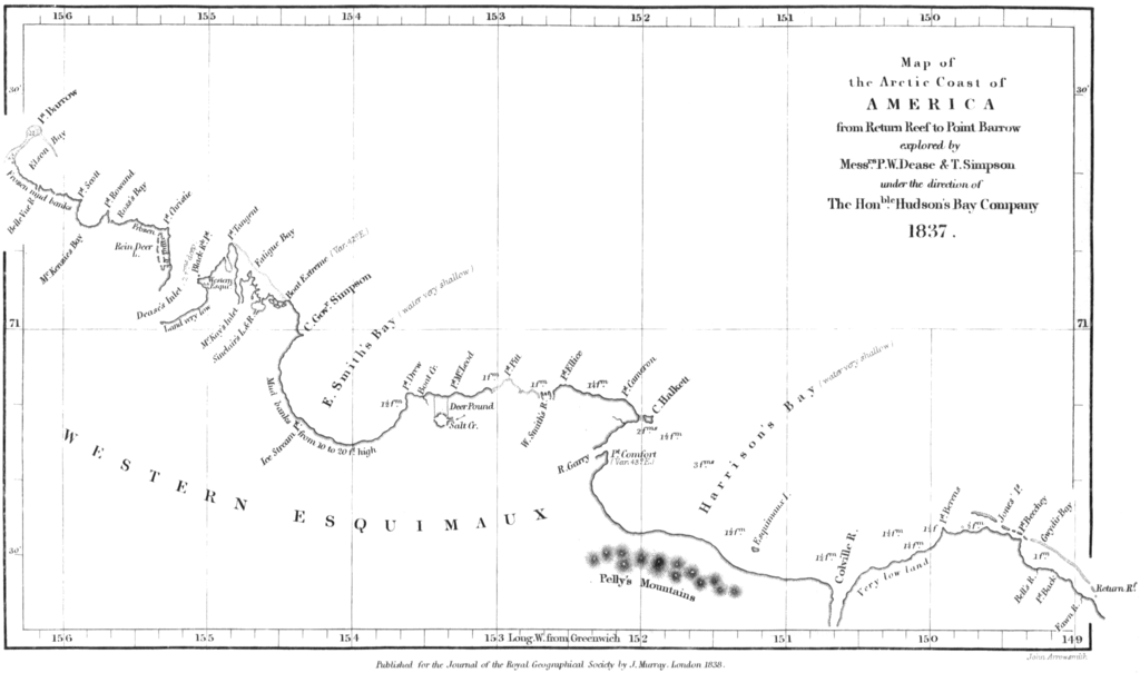
English: Map of the northern coast of Alaska, from Point Burrow on the western edge to Return Reef (just east of the Colville River) on the eastern. Mapped by Peter W. Dease and Thomas Simpson in 1837, during their Arctic expedition. |
|||||||||||||||||
| Data | ||||||||||||||||||
| Jatorria | Peter W. Dease and Thomas Simpson, "An Account of the Recent Arctic Discoveries by Messrs. Dease and T. Simpson", Journal of the Royal Geographical Society of London 8: 213-225, 1838. | |||||||||||||||||
| Egilea |
|
|||||||||||||||||

Lizentzia
|
Egilea 1873. urtean hil zen. Beraz, lan hau jabetza publikoan dago bai bere jatorrizko herrialdean, bai egile eskubideak egilea hil eta 100 urtera edo gutxiagora iraungitzen diren gainerako herrialdeetan. This work is in the public domain in the United States because it was published (or registered with the U.S. Copyright Office) before January 1, 1929. | |
| This file has been identified as being free of known restrictions under copyright law, including all related and neighboring rights. | |
Fitxategiaren historia
Data/orduan klik egin fitxategiak orduan zuen itxura ikusteko.
| Data/Ordua | Iruditxoa | Neurriak | Erabiltzailea | Iruzkina | |
|---|---|---|---|---|---|
| oraingoa | 12:29, 18 urtarrila 2009 | | 2.395 × 1.414 (288 KB) | Delirium | {{Information |Description={{en|1=Map of the northern coast of Alaska, from Point Burrow on the western edge to Return Reef (just east of the Colville River) on the eastern. Mapped by Peter W. Dease and Thomas Simpson in 1837, during their Arctic expediti |
Irudira dakarten loturak
Hurrengo orrialdeek dute fitxategi honetarako lotura:
Fitxategiaren erabilera orokorra
Hurrengo beste wikiek fitxategi hau darabilte:
- arz.wikipedia.org proiektuan duen erabilera
- bg.wikipedia.org proiektuan duen erabilera
- ca.wikipedia.org proiektuan duen erabilera
- ceb.wikipedia.org proiektuan duen erabilera
- es.wikipedia.org proiektuan duen erabilera
- fr.wikipedia.org proiektuan duen erabilera
- www.wikidata.org proiektuan duen erabilera