Fitxategi:Africa North 1578, Gerardus Mercator (4154597-recto).jpg
Bereizmen handikoa ((5.508 × 3.840 pixel, fitxategiaren tamaina: 2,68 MB, MIME mota: image/jpeg))
Fitxategi hau Wikimedia Commonsekoa da. Hango deskribapen orriko informazioa behean duzu. |
Laburpena
| Deskribapena |
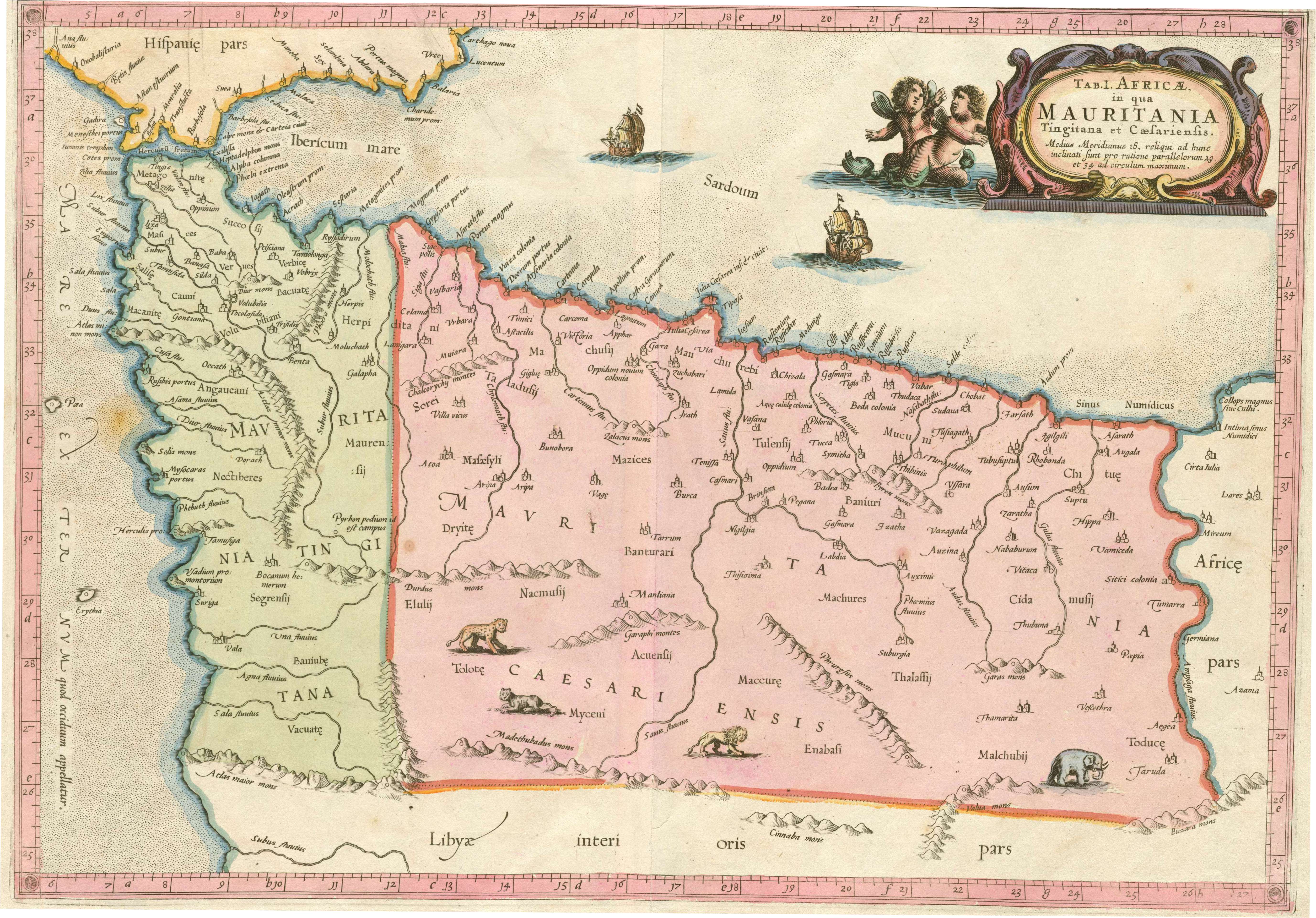
Latina: Tab. I. Africæ, in qua Mauritania Tingitana et Cæsariensis :medius meridianus 16, reliqui ad hunc inclinati sunt pro ratione parellelorum 29 et 34 ad circulum maximum.
English: Ptolemy's First Map of Africa, with Mauretania Tingitana and Caesariensis, covering modern Morocco and western Algeria. |
||||||||||||||||||||||||||
| Data | |||||||||||||||||||||||||||
| Jatorria | North West University Library, 16th-20th Century Maps of Africa, #4154597 | ||||||||||||||||||||||||||
| Egilea |
|
||||||||||||||||||||||||||
| Beste bertsioak |
|
||||||||||||||||||||||||||

.jpg)
.jpg)
Lizentzia
This image is in the public domain because it is a mere mechanical scan or photocopy of a public domain original, or – from the available evidence – is so similar to such a scan or photocopy that no copyright protection can be expected to arise. The original itself is in the public domain for the following reason:
This tag is designed for use where there may be a need to assert that any enhancements (eg brightness, contrast, colour-matching, sharpening) are in themselves insufficiently creative to generate a new copyright. It can be used where it is unknown whether any enhancements have been made, as well as when the enhancements are clear but insufficient. For known raw unenhanced scans you can use an appropriate {{PD-old}} tag instead. For usage, see Commons:When to use the PD-scan tag.  | ||||
Fitxategiaren historia
Data/orduan klik egin fitxategiak orduan zuen itxura ikusteko.
| Data/Ordua | Iruditxoa | Neurriak | Erabiltzailea | Iruzkina | |
|---|---|---|---|---|---|
| oraingoa | 23:35, 21 apirila 2016 | | 5.508 × 3.840 (2,68 MB) | Peter Mercator | Image cropped to get rid of black surround. |
| 11:39, 13 urria 2009 |  | 6.157 × 5.048 (3,71 MB) | Martin H. | == {{int:filedesc}} == {{Information |Description= Relief shown pictorially. Covers modern northern Morocco and Algeria. (Description from: [http://fedora.library.northwestern.edu/fedora/get/inu:inu-afrmap-4154597/inu:NWUCollectionBDef/getDefaultView No |
Irudira dakarten loturak
Hurrengo orrialdeek dute fitxategi honetarako lotura:
Fitxategiaren erabilera orokorra
Hurrengo beste wikiek fitxategi hau darabilte:
- ar.wikipedia.org proiektuan duen erabilera
- ary.wikipedia.org proiektuan duen erabilera
- en.wikipedia.org proiektuan duen erabilera
- es.wikipedia.org proiektuan duen erabilera
- it.wikipedia.org proiektuan duen erabilera
- mt.wikipedia.org proiektuan duen erabilera
- uk.wikipedia.org proiektuan duen erabilera
- www.wikidata.org proiektuan duen erabilera
.jpg)