Fitxategi:1630 barbarie mercator.jpg
Bereizmen handikoa ((2.727 × 2.075 pixel, fitxategiaren tamaina: 2,57 MB, MIME mota: image/jpeg))
Fitxategi hau Wikimedia Commonsekoa da. Hango deskribapen orriko informazioa behean duzu. |
Laburpena
| Deskribapena |
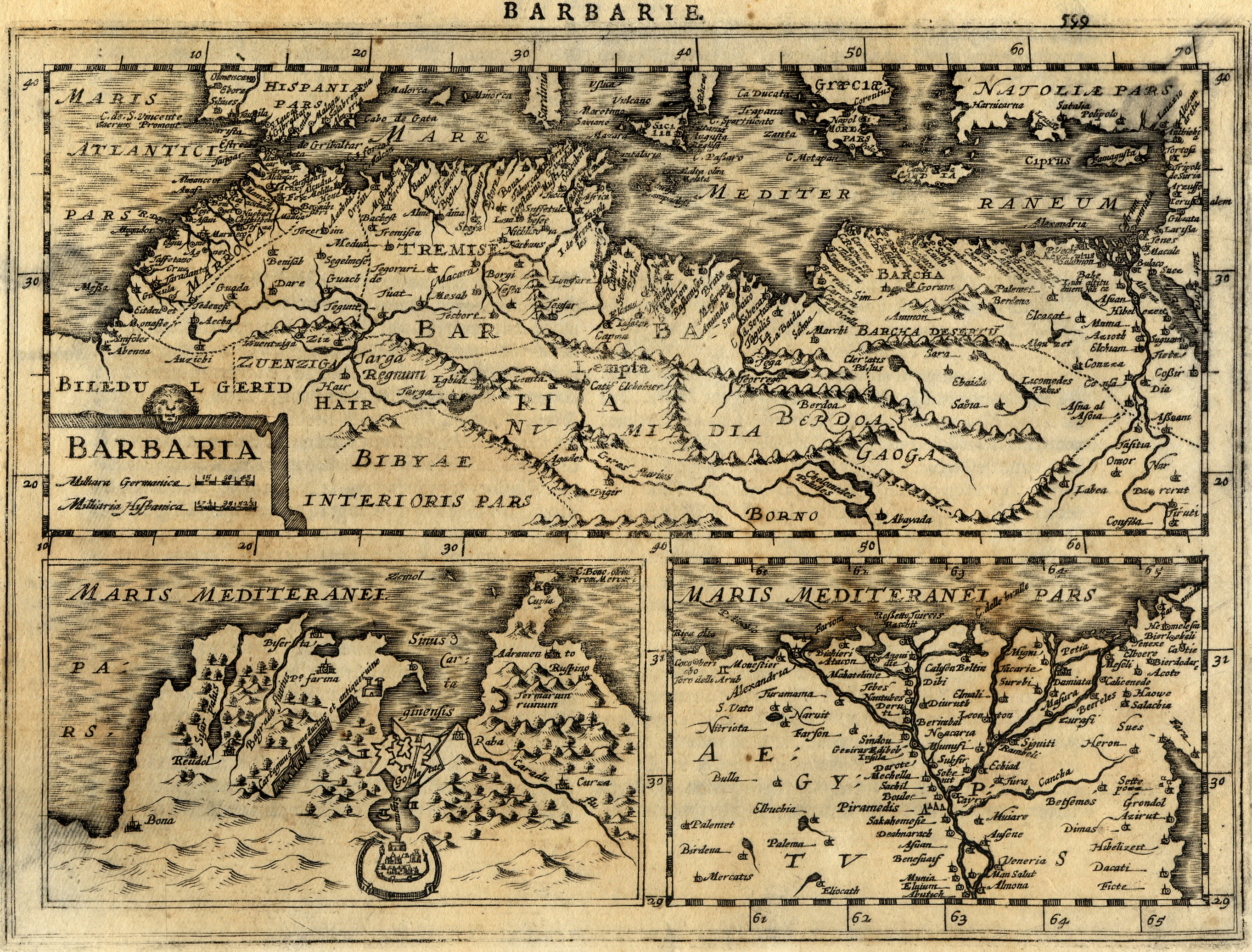
Français : Carte géographique ancienne de la Barbarie (Maghreb / Afrique du Nord / Maroc, Algérie, Tunisie, Lybie) dressée par le géographe Gerhard / Gerardus Mercator. Cette carte issue de l'Atlas Minor de Mercator a été gravée en 1630 par Jan Cloppenburgh à Amsterdam.
English: Map of Barbaria (Maghreb / Northern Africa / Morocco, Algeria, Tunisia, Libya) made by Gerhard / Gerardus Mercator. This map, coming from Atlas Minor of Mercator has been engraved by Jan Cloppenburgh in 1630 in Amsterdam. |
| Data | |
| Jatorria | ezgzegeg |
| Egilea | Gerhard / Gerardus Mercator & Jan Cloppenburgh (reproduit par histoirepostale.net) |
| Beste bertsioak | egg |
Lizentzia
This image is in the public domain because it is a mere mechanical scan or photocopy of a public domain original, or – from the available evidence – is so similar to such a scan or photocopy that no copyright protection can be expected to arise. The original itself is in the public domain for the following reason:
This tag is designed for use where there may be a need to assert that any enhancements (eg brightness, contrast, colour-matching, sharpening) are in themselves insufficiently creative to generate a new copyright. It can be used where it is unknown whether any enhancements have been made, as well as when the enhancements are clear but insufficient. For known raw unenhanced scans you can use an appropriate {{PD-old}} tag instead. For usage, see Commons:When to use the PD-scan tag.  | ||||
Fitxategiaren historia
Data/orduan klik egin fitxategiak orduan zuen itxura ikusteko.
| Data/Ordua | Iruditxoa | Neurriak | Erabiltzailea | Iruzkina | |
|---|---|---|---|---|---|
| oraingoa | 15:27, 21 apirila 2008 | | 2.727 × 2.075 (2,57 MB) | Dlebouc | {{Information |Description= |Source= |Date= |Author= |Permission= |other_versions= }} |
| 16:25, 2 urtarrila 2008 |  | 2.727 × 2.075 (2,57 MB) | Dlebouc | == Description == {{Information |Description= {{fr|Carte géographique ancienne du Maghreb / Afrique du Nord (Maroc, Algérie, Tunisie, Lybie) dressée par le géographe Gerhard Mercator en 1630. {{en|Map of Maghreb / Northern Africa (Morocco, Algeria, Tu |
Irudira dakarten loturak
Hurrengo orrialdeek dute fitxategi honetarako lotura:
Fitxategiaren erabilera orokorra
Hurrengo beste wikiek fitxategi hau darabilte:
- an.wikipedia.org proiektuan duen erabilera
- ar.wikipedia.org proiektuan duen erabilera
- ca.wikipedia.org proiektuan duen erabilera
- en.wikipedia.org proiektuan duen erabilera
- es.wikipedia.org proiektuan duen erabilera
- fr.wikipedia.org proiektuan duen erabilera
- gl.wikipedia.org proiektuan duen erabilera
- incubator.wikimedia.org proiektuan duen erabilera
- nl.wikipedia.org proiektuan duen erabilera
- pt.wikipedia.org proiektuan duen erabilera
- sc.wikipedia.org proiektuan duen erabilera