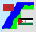
Fitxategi:Western Sahara conflict map.svg

SVG fitxategi honen PNG aurreikuspenaren tamaina: 677 × 600 pixel. Bestelako bereizmenak: 271 × 240 pixel | 542 × 480 pixel | 867 × 768 pixel | 1.156 × 1.024 pixel | 2.312 × 2.048 pixel | 1.472 × 1.304 pixel.
Bereizmen handikoa (SVG fitxategia, nominaldi 1.472 × 1.304 pixel, fitxategiaren tamaina: 88 KB)
Fitxategiaren historia
Data/orduan klik egin fitxategiak orduan zuen itxura ikusteko.
| Data/Ordua | Iruditxoa | Neurriak | Erabiltzailea | Iruzkina | |
|---|---|---|---|---|---|
| oraingoa | 03:52, 26 abendua 2020 |  | 1.472 × 1.304 (88 KB) | M.Bitton | Reverted to version as of 17:59, 13 July 2020 (UTC): Colours less intense, per the July edit |
| 02:31, 26 abendua 2020 |  | 1.472 × 1.304 (107 KB) | M.Bitton | Reverted to version as of 01:49, 29 November 2015 (UTC): This map is based on the UN's map | |
| 05:28, 25 abendua 2020 |  | 1.472 × 1.304 (121 KB) | EdDakhla | Reverted to version as of 17:23, 6 December 2020 (UTC) new source https://www.usnews.com/news/world/articles/2020-11-17/morocco-pm-says-western-sahara-wall-at-centre-of-dispute-completed | |
| 19:57, 6 abendua 2020 |  | 1.472 × 1.304 (88 KB) | M.Bitton | Reverted to version as of 17:59, 13 July 2020 (UTC): COM:OVERWRITE is there to revent the POV pushing. Back to the stable and sourced version | |
| 19:54, 6 abendua 2020 |  | 1.472 × 1.304 (121 KB) | Taha Khattabi | Reverted to version as of 17:38, 6 December 2020 (UTC) https://en.wikipedia.org/wiki/2020_Western_Saharan_clashes#Official_statements | |
| 19:47, 6 abendua 2020 |  | 1.472 × 1.304 (88 KB) | M.Bitton | Reverted to version as of 17:59, 13 July 2020 (UTC): Back to the stable and sourced version | |
| 19:38, 6 abendua 2020 |  | 1.472 × 1.304 (121 KB) | Taha Khattabi | Reverted to version as of 17:33, 6 December 2020 (UTC) | |
| 19:37, 6 abendua 2020 |  | 1.472 × 1.304 (88 KB) | M.Bitton | Reverted to version as of 17:59, 13 July 2020 (UTC) | |
| 19:33, 6 abendua 2020 |  | 1.472 × 1.304 (121 KB) | Taha Khattabi | Reverted to version as of 17:23, 6 December 2020 (UTC) Maybe the UN has not yet updated it but this is. Please refrain from edit warring | |
| 19:24, 6 abendua 2020 |  | 1.472 × 1.304 (88 KB) | M.Bitton | Reverted to version as of 17:59, 13 July 2020 (UTC):This map is based on a reliable source. The UN map. |
Irudira dakarten loturak
Hurrengo orrialdeek dute fitxategi honetarako lotura:
Fitxategiaren erabilera orokorra
Hurrengo beste wikiek fitxategi hau darabilte:
- ar.wikipedia.org proiektuan duen erabilera
- ast.wikipedia.org proiektuan duen erabilera
- az.wikipedia.org proiektuan duen erabilera
- ba.wikipedia.org proiektuan duen erabilera
- be.wikipedia.org proiektuan duen erabilera
- ca.wikipedia.org proiektuan duen erabilera
- Sàhara Occidental
- Enfrontaments al campament sahrauí de Gdeim Izik
- Exèrcit d'Alliberament Marroquí
- Consell Reial Consultiu pels Afers del Sàhara
- Províncies Meridionals
- Zona Lliure
- Plantilla:Conflicte del Sàhara Occidental
- Mur marroquí
- Estatut polític del Sàhara Occidental
- Resolució 1215 del Consell de Seguretat de les Nacions Unides
- Resolució 1754 del Consell de Seguretat de les Nacions Unides
- Resolució 1813 del Consell de Seguretat de les Nacions Unides
- Resolució 1871 del Consell de Seguretat de les Nacions Unides
- Revolta de Zemla
- Conflicte del Sàhara Occidental
- el.wikipedia.org proiektuan duen erabilera
- en.wikipedia.org proiektuan duen erabilera
- Western Sahara
- Politics of Western Sahara
- Political status of Western Sahara
- Polisario Front
- United Nations Mission for the Referendum in Western Sahara
- Moroccan Western Sahara Wall
- Spanish Sahara
- Ifni War
- Green March
- Saguia el-Hamra
- Madrid Accords
- November 1975
- Advisory opinion on Western Sahara
- Baker Plan
- Zemla Intifada
- Second Sahrawi Intifada
- Settlement Plan
- Moroccan Army of Liberation
- Sahrawi National Union Party
- Free Zone (region)
- 1975 United Nations visiting mission to Spanish Sahara
- Human rights in Western Sahara
- United Nations Security Council Resolution 1495
- Template:Western Sahara conflict
- Western Sahara conflict
- Royal Advisory Council for Saharan Affairs
- Politics of the Sahrawi Arab Democratic Republic
- Opération Lamantin
Ikus fitxategi honen erabilpen global gehiago.
