Fitxategi:Etsch.png

Aurreikuspen honen neurria: 578 × 600 pixel. Bestelako bereizmenak: 231 × 240 pixel | 463 × 480 pixel | 742 × 770 pixel.
Bereizmen handikoa ((742 × 770 pixel, fitxategiaren tamaina: 612 KB, MIME mota: image/png))
Fitxategi hau Wikimedia Commonsekoa da. Hango deskribapen orriko informazioa behean duzu. |
| Deskribapena |
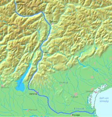
Deutsch: Karte von der de:Etsch English: map of Etsch/Adige |
| Data | |
| Jatorria | Norberak egina |
| Egilea | Frank |
| Beste bertsioak | Derivative works of this file: Etschtal.png |
This image is in the public domain because it came from the site https://www.demis.nl/products/web-map-server/examples/ and was released by the copyright holder. Permission is granted to copy, distribute and/or modify this map since it is based on free of copyright images from: www.demis.nl. See also approval email on de.wp and its clarification.
|
| This work has been released into the public domain by its copyright holder, www.demis.nl. This applies worldwide. Estatu batzuetan beharbada hori ez da legez posible izango. Halakoetan: www.demis.nl grants anyone the right to use this work for any purpose, without any conditions, unless such conditions are required by law.
|
Fitxategiaren historia
Data/orduan klik egin fitxategiak orduan zuen itxura ikusteko.
| Data/Ordua | Iruditxoa | Neurriak | Erabiltzailea | Iruzkina | |
|---|---|---|---|---|---|
| oraingoa | 15:48, 18 martxoa 2007 | | 742 × 770 (612 KB) | Frank-m | {{Information |Description={{de|Karte von der de:Etsch}} {{en|map of Etsch/Adige}} |Source=own work |Date=18.3.2007 |Author=~~~ |Permission= |other_versions= }} {{demis-pd}} Category:Adige |
Irudira dakarten loturak
Hurrengo orrialdeek dute fitxategi honetarako lotura:
Fitxategiaren erabilera orokorra
Hurrengo beste wikiek fitxategi hau darabilte:
- af.wikipedia.org proiektuan duen erabilera
- ar.wikipedia.org proiektuan duen erabilera
- arz.wikipedia.org proiektuan duen erabilera
- azb.wikipedia.org proiektuan duen erabilera
- be.wikipedia.org proiektuan duen erabilera
- ca.wikipedia.org proiektuan duen erabilera
- da.wikipedia.org proiektuan duen erabilera
- de.wikipedia.org proiektuan duen erabilera
- eo.wikipedia.org proiektuan duen erabilera
- fr.wikipedia.org proiektuan duen erabilera
- hy.wikipedia.org proiektuan duen erabilera
- is.wikipedia.org proiektuan duen erabilera
- it.wikipedia.org proiektuan duen erabilera
- it.wiktionary.org proiektuan duen erabilera
- ja.wikipedia.org proiektuan duen erabilera
- la.wikipedia.org proiektuan duen erabilera
- mk.wikipedia.org proiektuan duen erabilera
- ro.wikipedia.org proiektuan duen erabilera
- sh.wikipedia.org proiektuan duen erabilera
- uk.wikipedia.org proiektuan duen erabilera
- vec.wikipedia.org proiektuan duen erabilera
- www.wikidata.org proiektuan duen erabilera